File:Map of Warren County Ohio Highlighting Union Township.png
Jump to navigation
Jump to search
No higher resolution available.
Map_of_Warren_County_Ohio_Highlighting_Union_Township.png (460 × 535 pixels, file size: 31 KB, MIME type: image/png)
| Description |
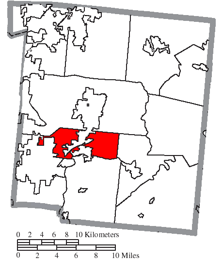
English: Map of the municipal and township boundaries of Warren County, Ohio, United States, as of the 2000 census, with the location of Union Township highlighted. Township borders are shown only in unincorporated areas in order to differentiate incorporated and unincorporated areas more clearly. |
| Date | |
| Source | File:Map of Warren County Ohio With Municipal and Township Labels.PNG |
| Author | Ruhrfisch and Nyttend |
| Permission (Reusing this file) |
This file is licensed under the Creative Commons Attribution-Share Alike 3.0 Unported license.
|
File history
Click on a date/time to view the file as it appeared at that time.
| Date/Time | Thumbnail | Dimensions | User | Comment | |
|---|---|---|---|---|---|
| current | 14:13, 19 August 2016 | | 460 × 535 (31 KB) | commons>Nyttend | Areas SW of Lebanon weren't highlighted |
File usage
There are no pages that use this file.