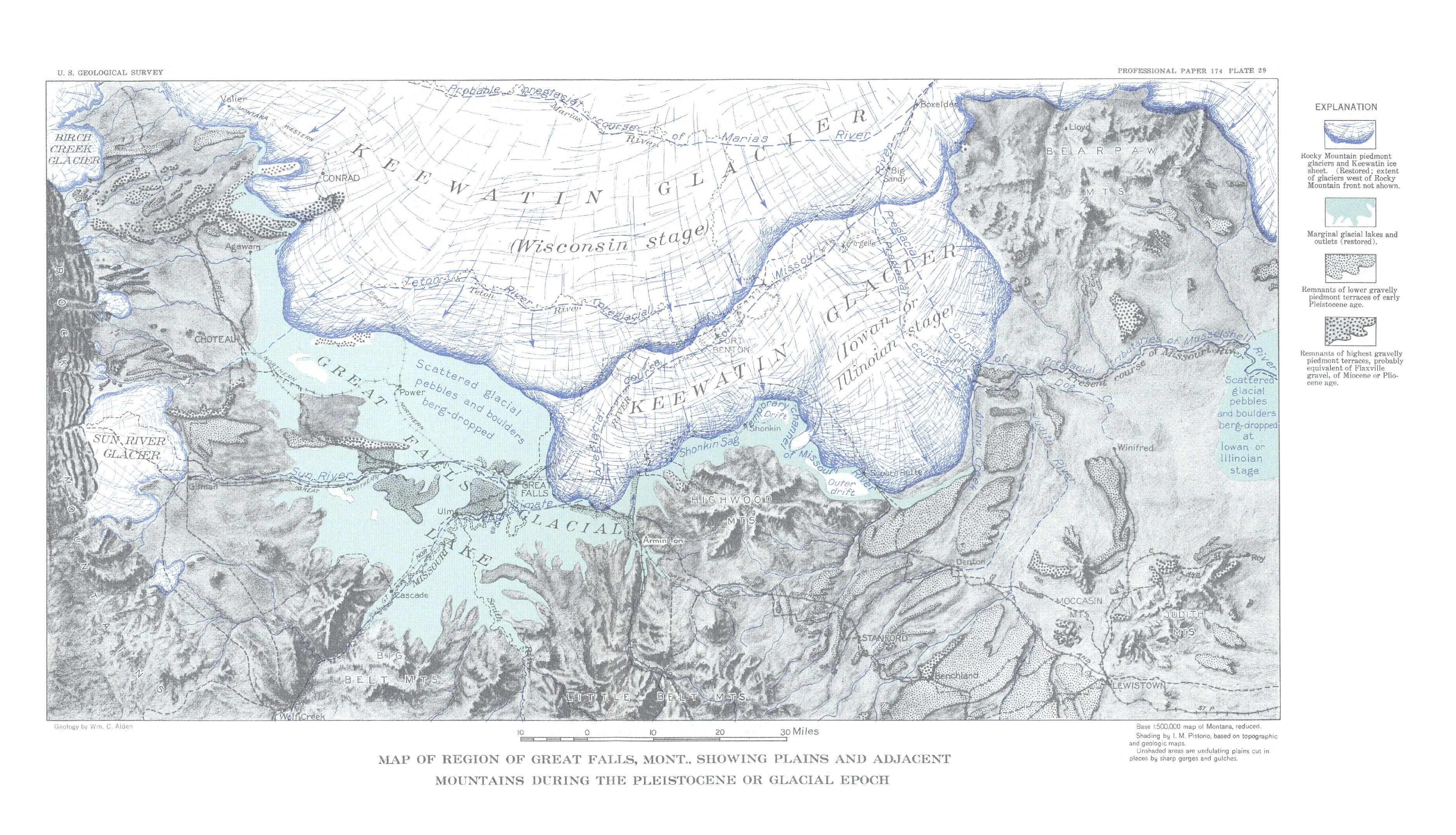
File:Map of Region of Great Falls, Montana (pg 88).jpg
Jump to navigation
Jump to search
Size of this preview: 800 × 459 pixels. Other resolutions: 320 × 184 pixels | 640 × 367 pixels | 1,024 × 587 pixels | 1,280 × 734 pixels | 2,560 × 1,469 pixels | 3,746 × 2,149 pixels.
Original file (3,746 × 2,149 pixels, file size: 1.77 MB, MIME type: image/jpeg)
.jpg)
File history
Click on a date/time to view the file as it appeared at that time.
| Date/Time | Thumbnail | Dimensions | User | Comment | |
|---|---|---|---|---|---|
| current | 22:12, 15 April 2020 | | 3,746 × 2,149 (1.77 MB) | commons>Chris Light | Uploaded a work by William C. Alden from William C. Alden; Physiography and Glacial Geology of Eastern Montana and Adjacent Areas, Professional Paper 174; Geological Survey, W. C. Mendenhall, Director; United States Department of the Interior, Ray Lyman Wilbur, Secretary; United States; Government Printing Office; Washington, D.C.; 1932 with UploadWizard |
File usage
There are no pages that use this file.
.jpg)