File:Map of Palms neighborhood, Los Angeles, California.png
Jump to navigation
Jump to search
No higher resolution available.
Map_of_Palms_neighborhood,_Los_Angeles,_California.png (696 × 452 pixels, file size: 490 KB, MIME type: image/png)
File history
Click on a date/time to view the file as it appeared at that time.
| Date/Time | Thumbnail | Dimensions | User | Comment | |
|---|---|---|---|---|---|
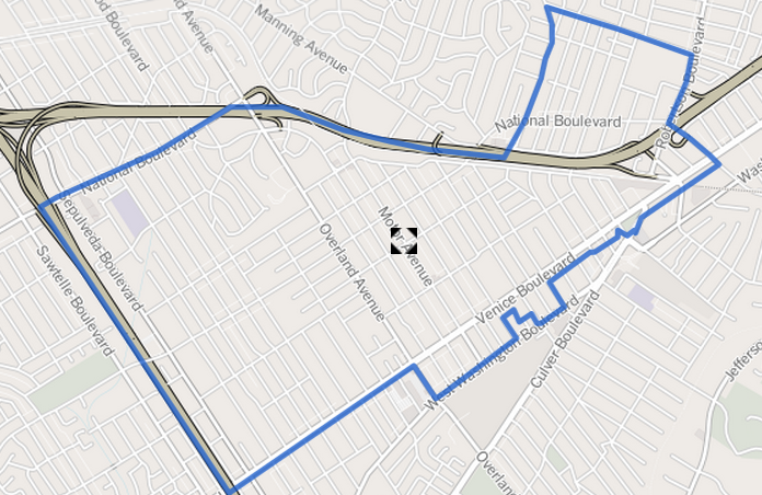
| current | 15:48, 22 April 2013 | | 696 × 452 (490 KB) | commons>BeenAroundAWhile | {{subst:Upload marker added by en.wp UW}} {{Information |Description = {{en|Map of the boundaries of the Palms neighborhood in Los Angeles, California, as determined by the "Mapping L.A." project of the Los Angeles Times. Will be used at [[:en:Palms, L... |
File usage
There are no pages that use this file.