File:Map of Oregon NA.png
Jump to navigation
Jump to search

Size of this preview: 800 × 541 pixels. Other resolutions: 320 × 217 pixels | 640 × 433 pixels | 1,024 × 693 pixels | 1,280 × 866 pixels | 1,967 × 1,331 pixels.
Original file (1,967 × 1,331 pixels, file size: 2.15 MB, MIME type: image/png)
Summary
| Description |
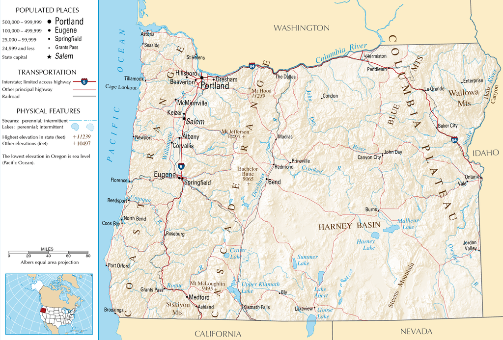
English: Topographic map of the geography of Oregon — with major rivers shown.
|
| Source | National Atlas |
| Author | Unknown author |
Licensing
This map was obtained from an edition of the National Atlas of the United States. Like almost all works of the U.S. federal government, works from the National Atlas are in the public domain in the United States.
Online access: NationalAtlas.gov | 1970 print edition: Library of Congress, Perry-Castañeda Library
|
File history
Click on a date/time to view the file as it appeared at that time.
| Date/Time | Thumbnail | Dimensions | User | Comment | |
|---|---|---|---|---|---|
| current | 05:46, 16 October 2007 | | 1,967 × 1,331 (2.15 MB) | commons>Peteforsyth | removed extraneous text and logo from public domain image |
File usage
There are no pages that use this file.