File:Map of Ontario NORTHERN.svg
Jump to navigation
Jump to search

Size of this PNG preview of this SVG file: 340 × 330 pixels. Other resolutions: 247 × 240 pixels | 495 × 480 pixels | 791 × 768 pixels | 1,055 × 1,024 pixels | 2,110 × 2,048 pixels.
Original file (SVG file, nominally 340 × 330 pixels, file size: 83 KB)
File history
Click on a date/time to view the file as it appeared at that time.
| Date/Time | Thumbnail | Dimensions | User | Comment | |
|---|---|---|---|---|---|
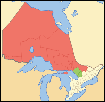
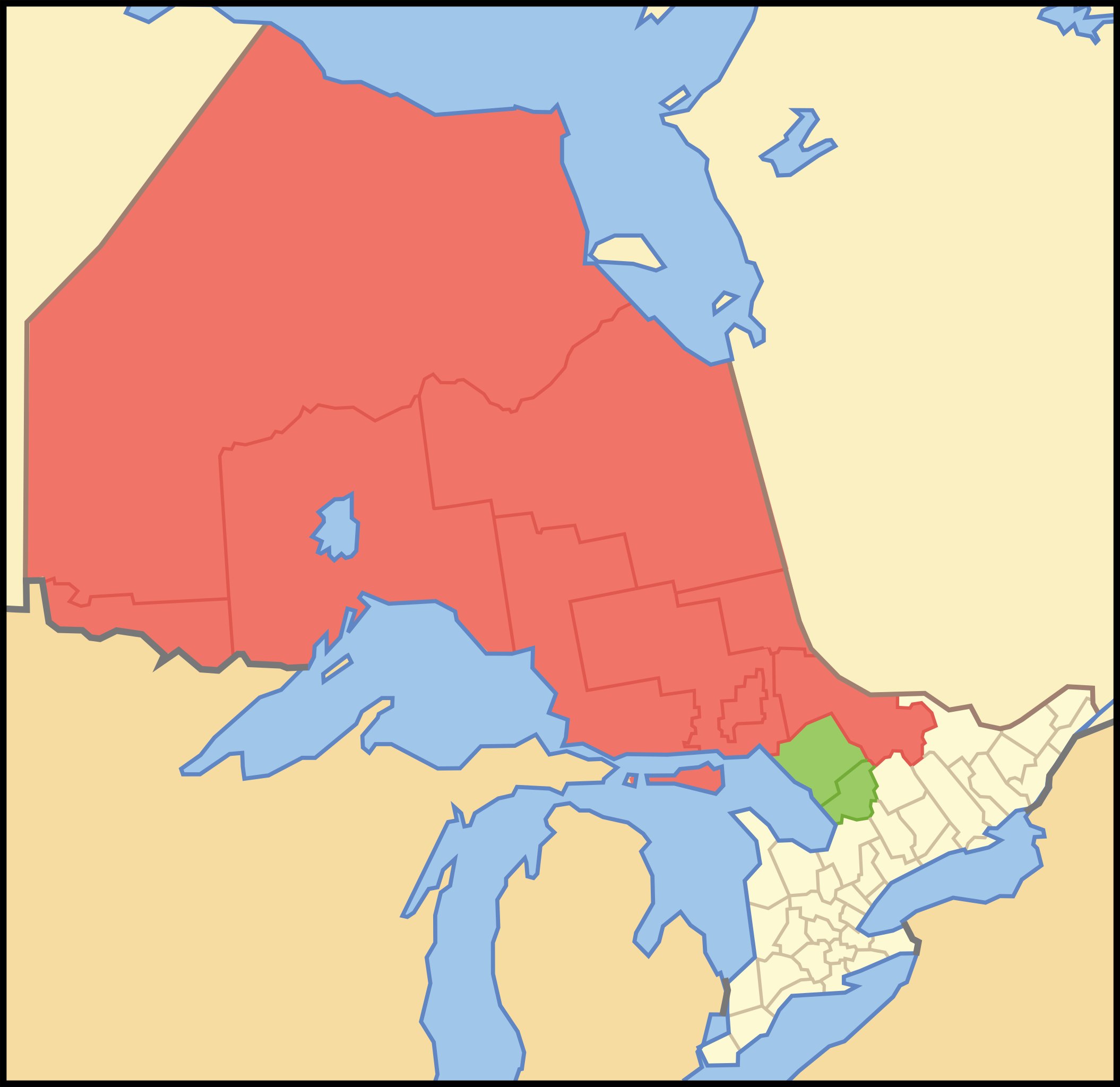
| current | 12:03, 12 October 2007 | | 340 × 330 (83 KB) | commons>Vidioman | {{Created with Inkscape}} {{Information |Description=Map showing Northern Ontario. Red is the districts always considered Northern Ontario. Green are the districts sometimes considered Northern Ontario. |Source=Crop and trace of [[:Image:Canada (geolocali |
File usage
There are no pages that use this file.