File:Map of North America with the Western Interior Seaway during the Campanian (Upper Cretaceous).png
Jump to navigation
Jump to search

Size of this preview: 488 × 600 pixels. Other resolutions: 195 × 240 pixels | 390 × 480 pixels | 625 × 768 pixels | 833 × 1,024 pixels | 1,945 × 2,391 pixels.
Original file (1,945 × 2,391 pixels, file size: 3.95 MB, MIME type: image/png)
.png)
File history
Click on a date/time to view the file as it appeared at that time.
| Date/Time | Thumbnail | Dimensions | User | Comment | |
|---|---|---|---|---|---|
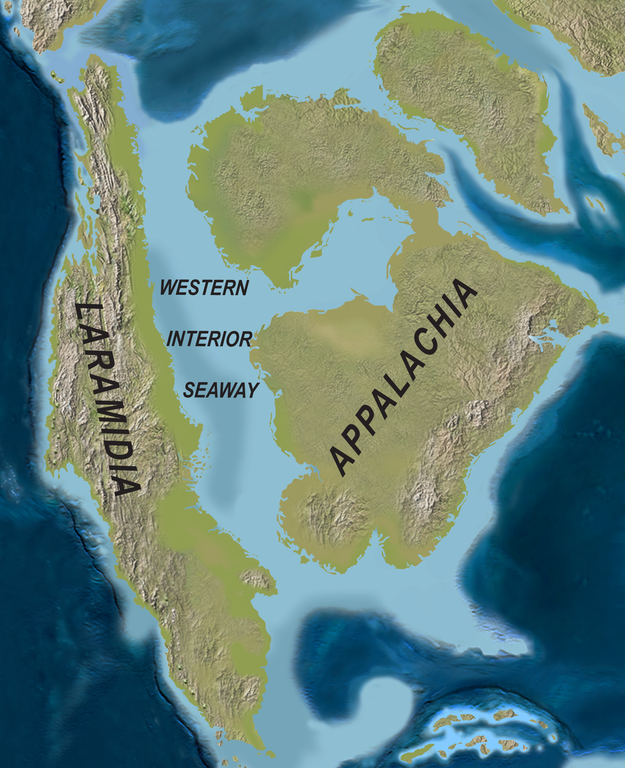
| current | 21:08, 1 April 2020 | | 1,945 × 2,391 (3.95 MB) | commons>FunkMonk | {{Information |Description = {{en|1=Map of North America with the Western Interior Seaway during the Campanian (Upper Cretaceous). Paleogeography of North America during the late Campanian Stage of the Late Cretaceous (∼75 Ma). Modified after Blakey.}} {{de|1=Karte von Nordamerika mit dem Western Interior Seaway während des Campaniums (Obere Kreide)}} |Source =http://www.plosone.org/article/info%3Adoi%2F10.1371%2Fjournal.pone.0012292 |Author =Scott D. Sampson, Mark A. Loewe... |
File usage
There are no pages that use this file.
.png)