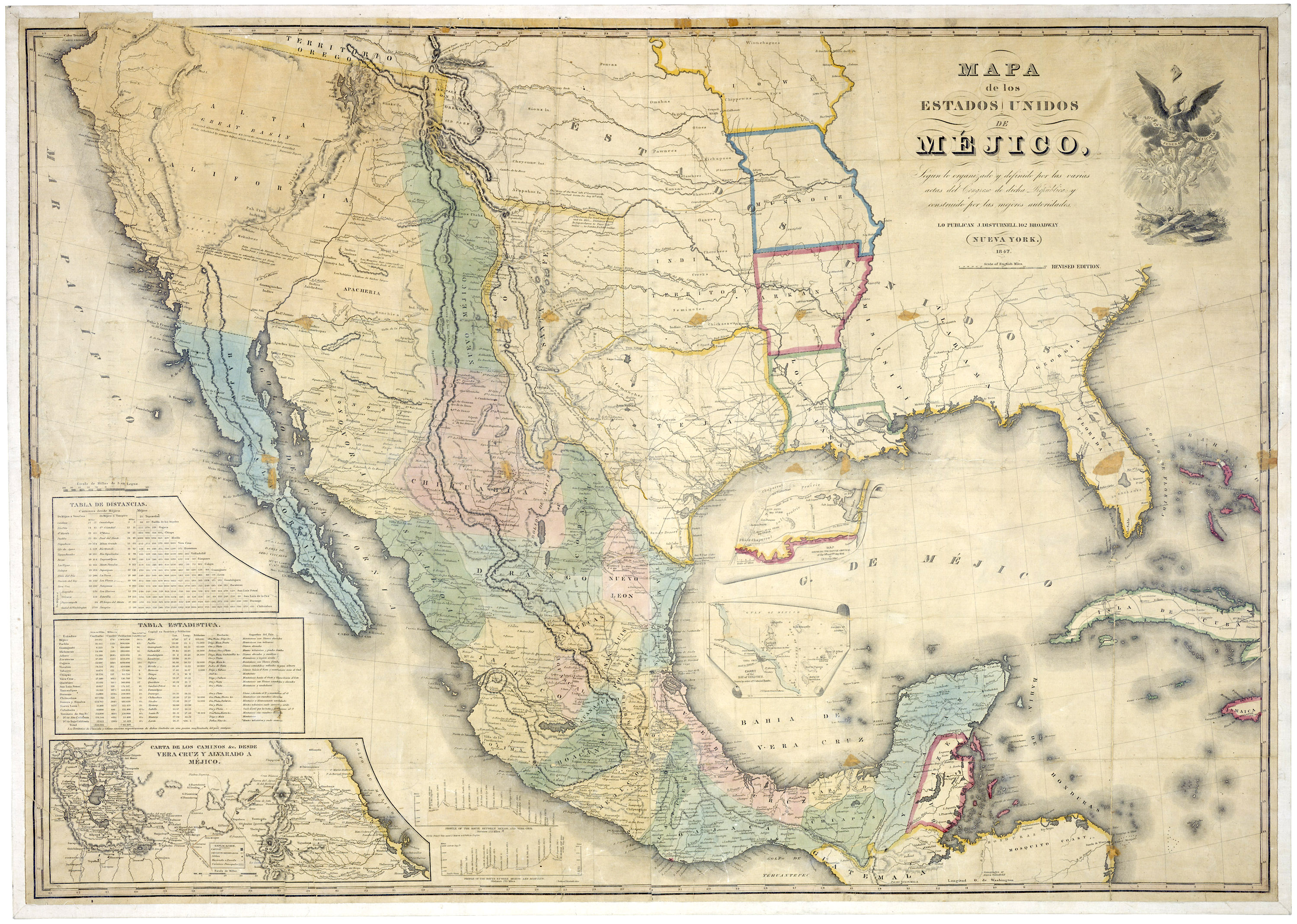
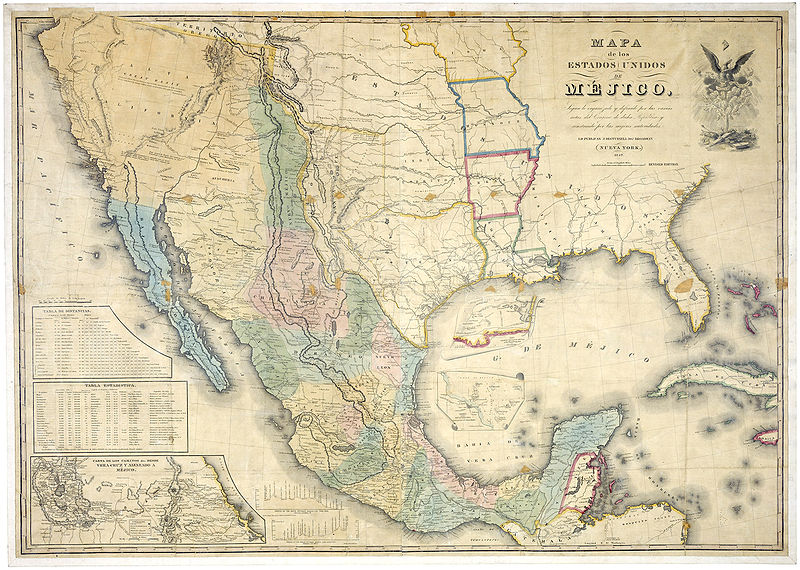
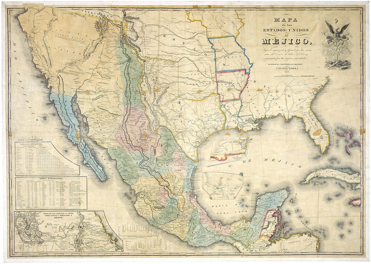
File:Map of Mexico 1847.jpg
Jump to navigation
Jump to search
Size of this preview: 800 × 570 pixels. Other resolutions: 320 × 228 pixels | 640 × 456 pixels | 1,024 × 730 pixels | 1,280 × 912 pixels | 2,560 × 1,824 pixels | 3,000 × 2,138 pixels.
Original file (3,000 × 2,138 pixels, file size: 1.87 MB, MIME type: image/jpeg)
File history
Click on a date/time to view the file as it appeared at that time.
| Date/Time | Thumbnail | Dimensions | User | Comment | |
|---|---|---|---|---|---|
| current | 21:18, 16 December 2006 | | 3,000 × 2,138 (1.87 MB) | commons>Electionworld | {{ew|en|Gflores}} == Summary == http://www.archives.gov/publications/prologue/2005/summer/images/mexico-disturnell-l.jpg Claimed Territory most not setttled == Licensing == {{PD-USGov}} |
File usage
There are no pages that use this file.