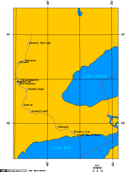
File:Map of Grand River, Ontario.png
Jump to navigation
Jump to search
Size of this preview: 437 × 599 pixels. Other resolutions: 175 × 240 pixels | 514 × 705 pixels.
Original file (514 × 705 pixels, file size: 10 KB, MIME type: image/png)
File history
Click on a date/time to view the file as it appeared at that time.
| Date/Time | Thumbnail | Dimensions | User | Comment | |
|---|---|---|---|---|---|
| current | 18:15, 3 February 2008 | | 514 × 705 (10 KB) | commons>Balcer~commonswiki | Original caption from English Wikipedia follows: == Map of the Grand River, in Ontario Canada == I created this map of the Grand River, in Ontario Canada. I used [http://www.aquarius.geomar.de/omc_bg_info.html this cool online map creation |
File usage
There are no pages that use this file.