File:Map of Efate Island EN.png
Jump to navigation
Jump to search

Size of this preview: 782 × 600 pixels. Other resolutions: 313 × 240 pixels | 626 × 480 pixels | 1,002 × 768 pixels | 1,280 × 981 pixels | 2,560 × 1,963 pixels | 2,903 × 2,226 pixels.
Original file (2,903 × 2,226 pixels, file size: 362 KB, MIME type: image/png)
Summary
| Description |
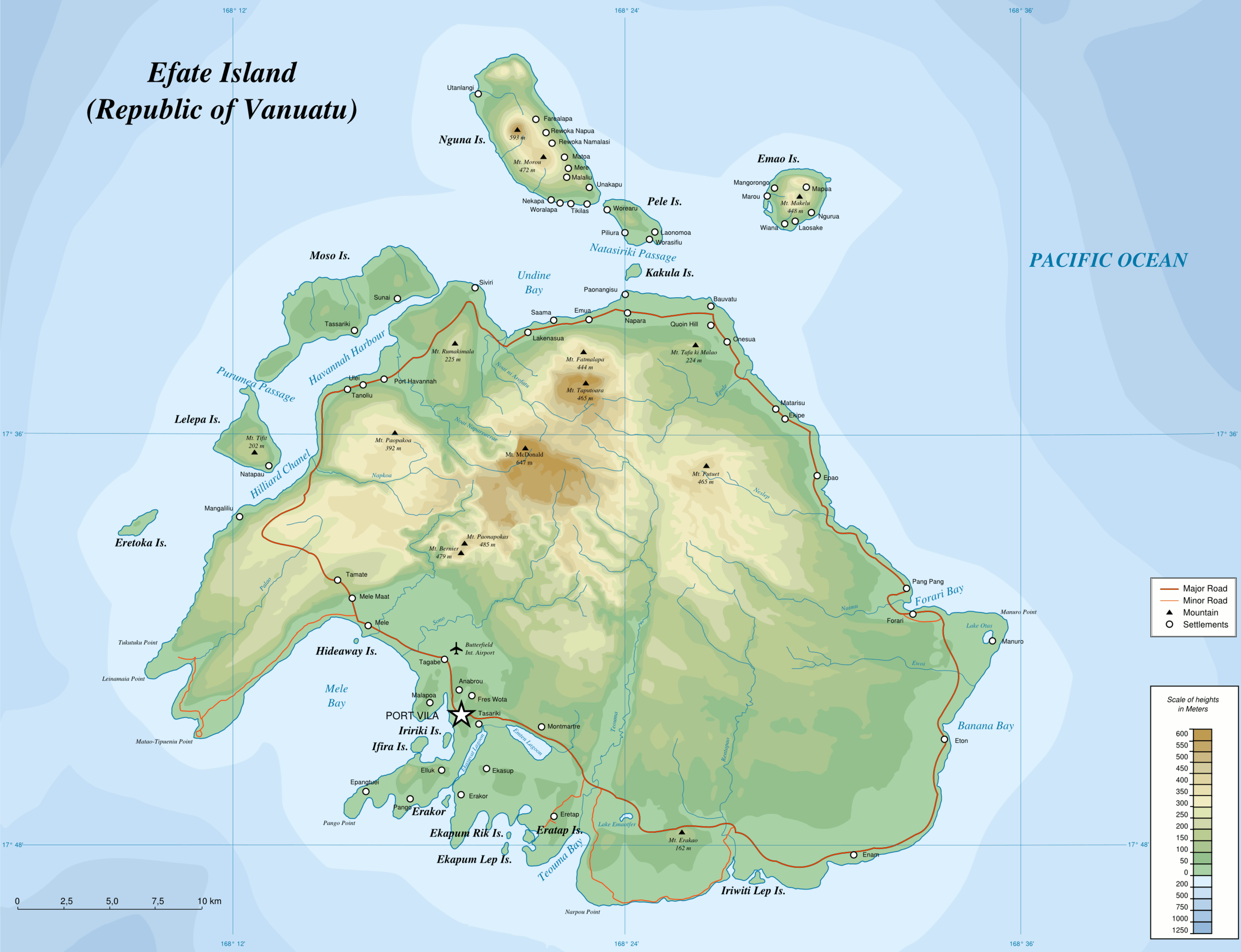
English: Topographic Map of Efate Island (Vanuatu) - PNG version
|
| Date | 12.03.2008 |
| Source |
Own work.
Data sources :
Softwares used :
Slight enhancement of features in this english version made possible by http://www.avisvanuatu.com/images/efate.jpg Others :
|
| Author | Переход Артур, english translation: Hk kng |
| Permission (Reusing this file) |
CC-BY-SA |
| Other versions | Image:Map of Efate Island EN.svg |
Licensing
This file is licensed under the Creative Commons Attribution-Share Alike 3.0 Unported license.
- You are free:
- to share – to copy, distribute and transmit the work
- to remix – to adapt the work
- Under the following conditions:
- attribution – You must give appropriate credit, provide a link to the license, and indicate if changes were made. You may do so in any reasonable manner, but not in any way that suggests the licensor endorses you or your use.
- share alike – If you remix, transform, or build upon the material, you must distribute your contributions under the same or compatible license as the original.
File history
Click on a date/time to view the file as it appeared at that time.
| Date/Time | Thumbnail | Dimensions | User | Comment | |
|---|---|---|---|---|---|
| current | 18:53, 31 October 2008 | | 2,903 × 2,226 (362 KB) | commons>Hk kng | {{Information |Description={{en|Topographic Map of Efate Island (Vanuatu) - PNG version}} {{ru|Топографическая карта острова Эфате (Республика Вануату)}} |Source=Ow |
File usage
There are no pages that use this file.