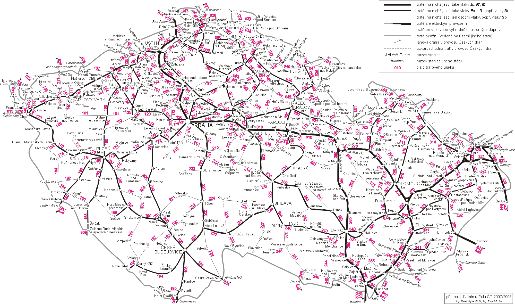
File:Map of Czech railways.gif
Jump to navigation
Jump to search
Size of this preview: 800 × 472 pixels. Other resolutions: 320 × 189 pixels | 640 × 377 pixels | 1,024 × 604 pixels | 1,280 × 755 pixels | 2,000 × 1,179 pixels.
Original file (2,000 × 1,179 pixels, file size: 371 KB, MIME type: image/gif)
File history
Click on a date/time to view the file as it appeared at that time.
| Date/Time | Thumbnail | Dimensions | User | Comment | |
|---|---|---|---|---|---|
| current | 11:16, 25 June 2008 | | 2,000 × 1,179 (371 KB) | commons>Erwin1990 | {{Information |Description={{en|1=Railway map of Czech Republic}} {{nl|1=Spoorwegenkaart van Tsjechië}} |Source=http://www.cdrail.cz/cp1250/sluzby/online/kjr_2005.gif |Author=Czech railway company: České dráhy, a.s. |Date=2005 |Permission={{OTRS pendi |
File usage
There are no pages that use this file.