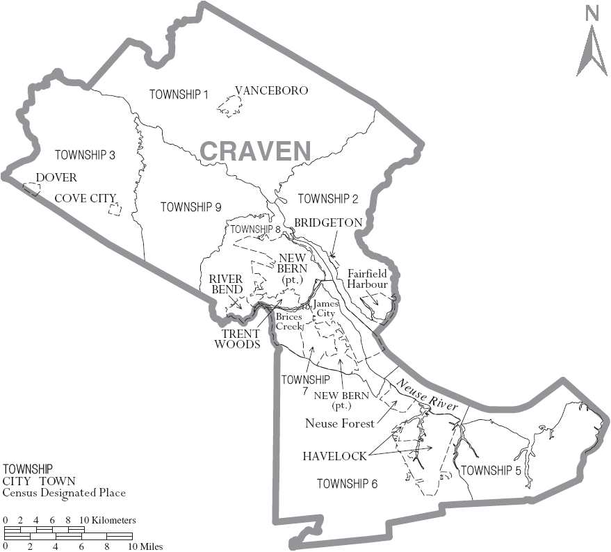
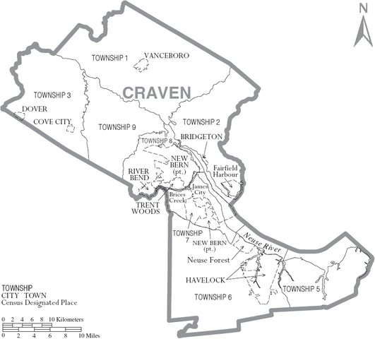
File:Map of Craven County North Carolina With Municipal and Township Labels.PNG
Jump to navigation
Jump to search
Size of this preview: 664 × 600 pixels. Other resolutions: 266 × 240 pixels | 531 × 480 pixels | 879 × 794 pixels.
Original file (879 × 794 pixels, file size: 79 KB, MIME type: image/png)
File history
Click on a date/time to view the file as it appeared at that time.
| Date/Time | Thumbnail | Dimensions | User | Comment | |
|---|---|---|---|---|---|
| current | 15:14, 4 July 2007 | | 879 × 794 (79 KB) | commons>Ruhrfisch | {{Information| |Description= Map of Craven County, North Carolina, United States with township and municipal boundaries |Source= taken from US Census website [http://www2.census.gov/geo/maps/general_ref/cousub_outline/cen2k_pgsz/nc_cosub.pdf] and modifie |
File usage
There are no pages that use this file.