File:Map hamburg rail 1910.jpg

Original file (2,488 × 1,867 pixels, file size: 1.29 MB, MIME type: image/jpeg)
Summary
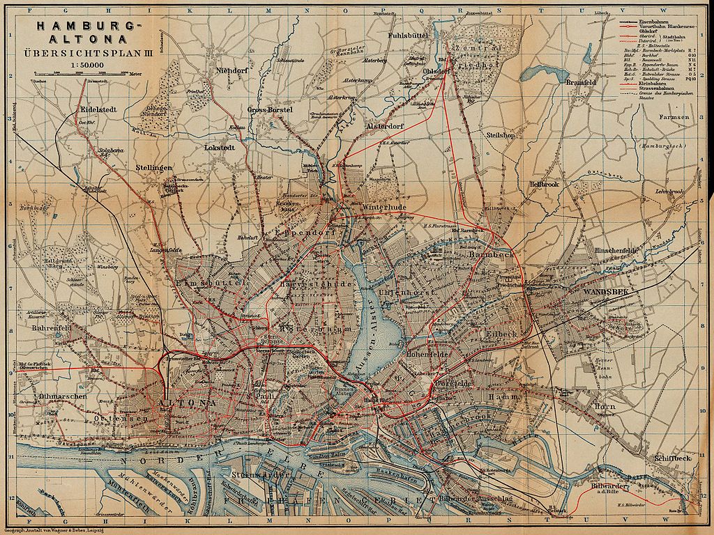
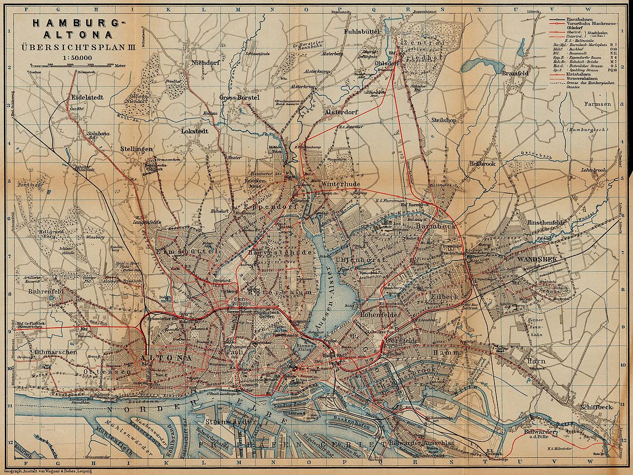
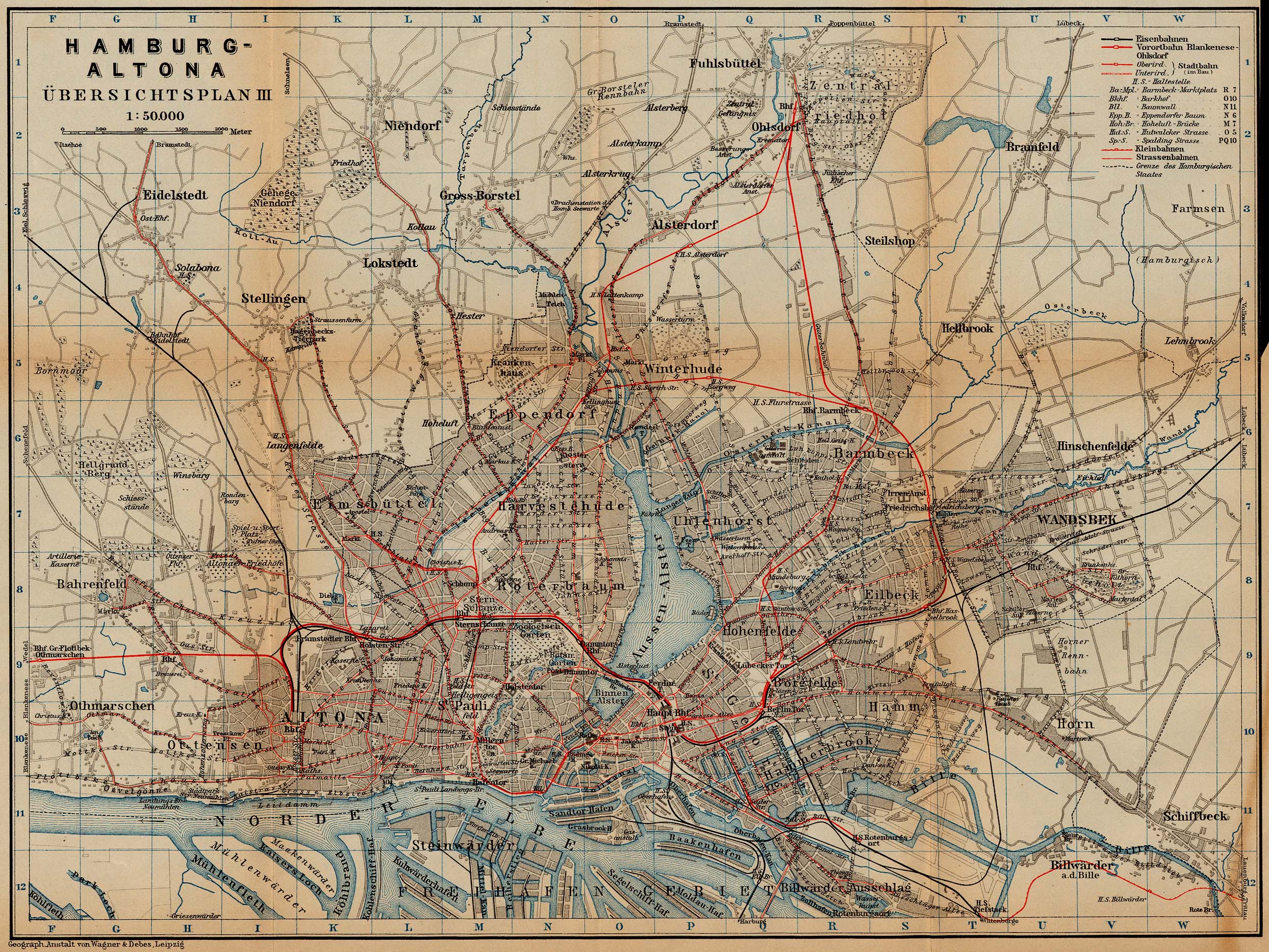
| Description | Railway and tramway map of Hamburg and Altona, about 1910 |
| Date | |
| Source | http://www.lib.utexas.edu/maps/historical/baedeker_n_germany_1910/hamburg_rail_1910.jpg |
| Author | "Northern Germany as far as the Bavarian and Austrian Frontiers; Handbook for Travellers" by Karl Baedeker. Fifteenth Revised Edition. Leipzig, Karl Baedeker; New York, Charles Scribner's Sons 1910. |
| Permission (Reusing this file) |
"Courtesy of the University of Texas Libraries, The University of Texas at Austin." http://www.lib.utexas.edu/maps/map_sites/hist_sites.html |
Licensing
|
This work is in the public domain in its country of origin and other countries and areas where the copyright term is the author's life plus 70 years or fewer.
| |
| This file has been identified as being free of known restrictions under copyright law, including all related and neighboring rights. | |
File history
Click on a date/time to view the file as it appeared at that time.
| Date/Time | Thumbnail | Dimensions | User | Comment | |
|---|---|---|---|---|---|
| current | 00:41, 23 April 2006 | | 2,488 × 1,867 (1.29 MB) | commons>700 MB | {{Information| |Description=Hamburg and Altona (railway and tramway map) |Source=http://www.lib.utexas.edu/maps/historical/baedeker_n_germany_1910/hamburg_rail_1910.jpg |Date=1910 |Author="Northern Germany as far as the Bavarian and Austrian Frontiers; H |
File usage
There are no pages that use this file.