File:Map 4thVoyage ChristopherColumbus 1502-4.svg
Jump to navigation
Jump to search

Size of this PNG preview of this SVG file: 744 × 489 pixels. Other resolutions: 320 × 210 pixels | 640 × 421 pixels | 1,024 × 673 pixels | 1,280 × 841 pixels | 2,560 × 1,683 pixels.
Original file (SVG file, nominally 744 × 489 pixels, file size: 734 KB)
File history
Click on a date/time to view the file as it appeared at that time.
| Date/Time | Thumbnail | Dimensions | User | Comment | |
|---|---|---|---|---|---|
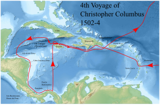
| current | 20:23, 5 November 2020 | | 744 × 489 (734 KB) | commons>Lobsterthermidor | {{Information |Description=Map of Caribbean Sea showing the 4th Voyage of Christopher Columbus, 1502-4 |Source=Amended from File:Christopher Columbus fourth voyage 1502-1504 map-fr.svg (in French) by User:Sémhur |Date=2020 |Author=~~~~ |Permission= |other_versions= }} Category:Bastimentos, Portobelo Category:Bastimentos Island, Bocas del Toro |
File usage
There are no pages that use this file.