File:Manistique Michigan aerial view.jpg
Jump to navigation
Jump to search

Size of this preview: 800 × 562 pixels. Other resolutions: 320 × 225 pixels | 640 × 449 pixels | 1,024 × 719 pixels | 1,280 × 899 pixels | 1,500 × 1,053 pixels.
Original file (1,500 × 1,053 pixels, file size: 601 KB, MIME type: image/jpeg)
| Description |
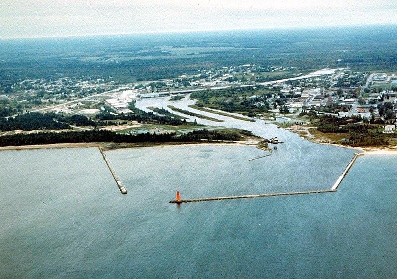
English: Aerial view of Manistique, Michigan, USA. The city lies on the northern shore of Lake Michigan in the Upper Peninsula of Michigan. The Manistique River flows through the town and into Lake Michigan through the harbor. |
|||
| Date | not specified or unknown | |||
| Source |
U.S. Army Corps of Engineers Digital Visual Library Image page Image description page Digital Visual Library home page |
|||
| Author | U.S. Army Corps of Engineers, photographer not specified or unknown | |||
| Permission (Reusing this file) |
|
|||
| Location | Manistique, Schoolcraft County, Michigan, USA |
| Camera location | | View this and other nearby images on: OpenStreetMap |
|---|
File history
Click on a date/time to view the file as it appeared at that time.
| Date/Time | Thumbnail | Dimensions | User | Comment | |
|---|---|---|---|---|---|
| current | 01:30, 30 March 2007 | | 1,500 × 1,053 (601 KB) | commons>DanMS | {{Information | Description = {{en|Aerial view of Manistique, Michigan, USA. The city lies on the northern shore of Lake Michigan in the Upper Peninsula of Michigan. The Manistique River flows through the town and into Lake Michigan through the harbor. |
File usage
There are no pages that use this file.