File:Manicaland in Zimbabwe (adm).svg
Jump to navigation
Jump to search

Size of this PNG preview of this SVG file: 662 × 600 pixels. Other resolutions: 265 × 240 pixels | 530 × 480 pixels | 847 × 768 pixels | 1,130 × 1,024 pixels | 2,260 × 2,048 pixels | 832 × 754 pixels.
Original file (SVG file, nominally 832 × 754 pixels, file size: 269 KB)
.svg)
File history
Click on a date/time to view the file as it appeared at that time.
| Date/Time | Thumbnail | Dimensions | User | Comment | |
|---|---|---|---|---|---|
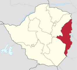
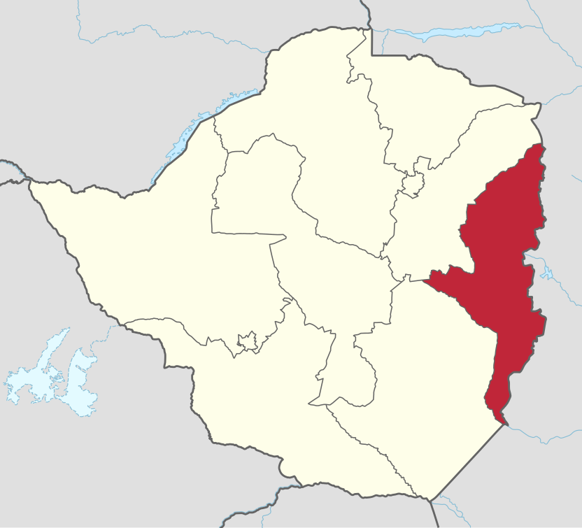
| current | 23:11, 3 August 2018 | | 832 × 754 (269 KB) | commons>Furfur | == {{int:filedesc}} == {{Information |Description={{User:Medium69/Traduction}} {{de|1=Verwaltungsgliederung von Simbabwe: Lage von Manicaland South.}} {{en|1=Administrative divisions of Zimbabwe: location of Manicaland South.}} |Source={{Derived from|Zimbabwe adm location map.svg}} |Date=2018-08-04 |Author=* Zimbabwe adm location map.svg: {{U|NNW}} * this file: {{U|Furfur}} |Permission={{self|GFDL|cc-by-sa-4.0}} |Other fields={{Igen|A|+|%|s=m}} }} [[Cat... |
File usage
There are no pages that use this file.
.svg)