File:Manchester parish map.svg
Jump to navigation
Jump to search

Size of this PNG preview of this SVG file: 673 × 599 pixels. Other resolutions: 270 × 240 pixels | 539 × 480 pixels | 863 × 768 pixels | 1,150 × 1,024 pixels | 2,300 × 2,048 pixels | 913 × 813 pixels.
Original file (SVG file, nominally 913 × 813 pixels, file size: 246 KB)
File history
Click on a date/time to view the file as it appeared at that time.
| Date/Time | Thumbnail | Dimensions | User | Comment | |
|---|---|---|---|---|---|
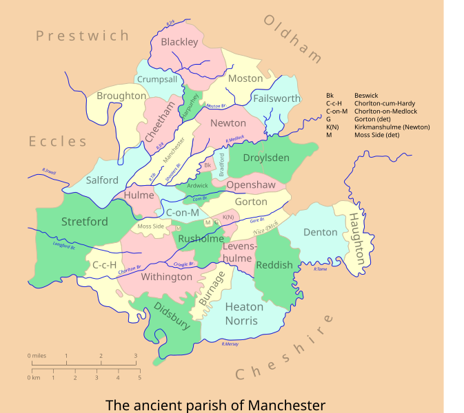
| current | 23:15, 28 January 2007 | | 913 × 813 (246 KB) | commons>Mr Stephen | {{Information |Description=A vectorised & colorised version of the map at Farrer & Brownbill (1911), The Victoria history of the county of Lancaster. - Lancashire, Vol 4, p 175. |Source=Own work, after Farrer & Brownbill |Date=Jan 2007 |Author=Mr Stephen |
File usage
There are no pages that use this file.