File:MainlandMoineOutcrop.png
Jump to navigation
Jump to search
Size of this preview: 424 × 600 pixels. Other resolutions: 170 × 240 pixels | 339 × 480 pixels | 744 × 1,052 pixels.
Original file (744 × 1,052 pixels, file size: 217 KB, MIME type: image/png)
File history
Click on a date/time to view the file as it appeared at that time.
| Date/Time | Thumbnail | Dimensions | User | Comment | |
|---|---|---|---|---|---|
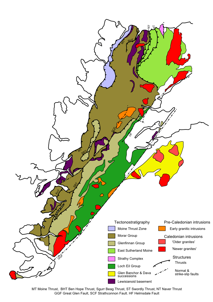
| current | 17:51, 10 September 2009 | | 744 × 1,052 (217 KB) | commons>Mikenorton | {{Information |Description={{en|1=Map of the outcrop of the Moine Supergroup on mainland Scotland and Inner Hebrides. Based on several published maps, particularly several maps in the Geology of Scotland [http://books.google.co.uk/books?id=ObdepEp9r7kC&pg |
File usage
There are no pages that use this file.