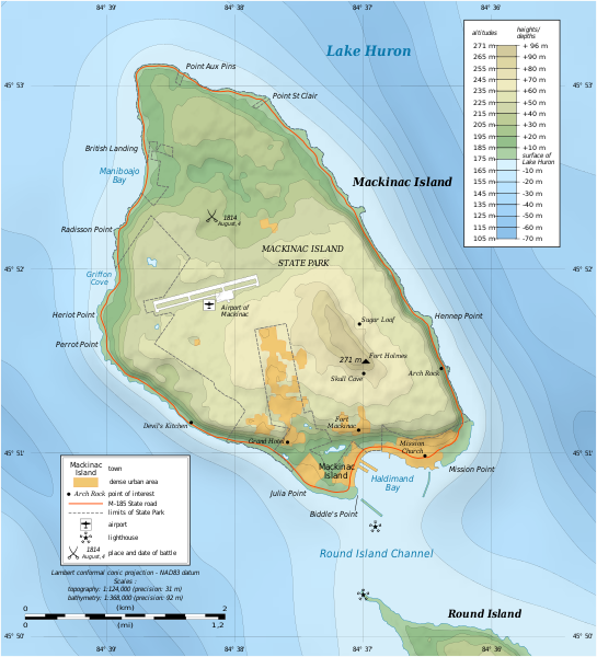
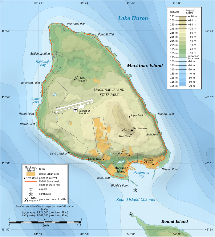
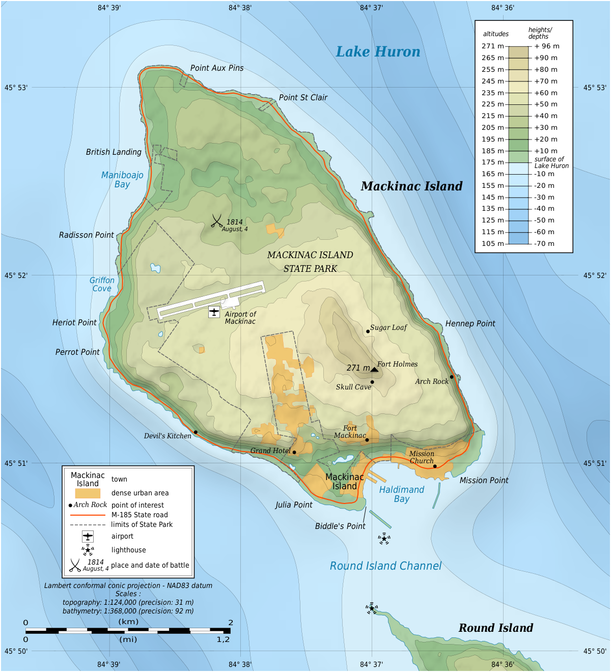
File:Mackinac Island topographic map-en.svg
Jump to navigation
Jump to search

Size of this PNG preview of this SVG file: 545 × 600 pixels. Other resolutions: 218 × 240 pixels | 436 × 480 pixels | 698 × 768 pixels | 931 × 1,024 pixels | 1,862 × 2,048 pixels | 1,200 × 1,320 pixels.
Original file (SVG file, nominally 1,200 × 1,320 pixels, file size: 457 KB)
File history
Click on a date/time to view the file as it appeared at that time.
| Date/Time | Thumbnail | Dimensions | User | Comment | |
|---|---|---|---|---|---|
| current | 17:43, 7 July 2010 | | 1,200 × 1,320 (457 KB) | commons>Liandrei | fix |
File usage
There are no pages that use this file.