File:LuxembourgPartitionsMap english.png
Jump to navigation
Jump to search
No higher resolution available.
LuxembourgPartitionsMap_english.png (433 × 569 pixels, file size: 62 KB, MIME type: image/png)
File history
Click on a date/time to view the file as it appeared at that time.
| Date/Time | Thumbnail | Dimensions | User | Comment | |
|---|---|---|---|---|---|
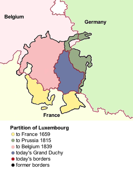
| current | 05:39, 20 March 2011 | | 433 × 569 (62 KB) | commons>Cdw1952 | {{Information |Description ={{en|1=Map showing the partition of Luxembourg through the centuries. I cleaned up the original file (LuxembourgPartitionsMap_english.jpg) and saved it in Portable Network Graphics format.}} |Source =LuxembourgPartit |
File usage
There are no pages that use this file.