File:Liaorivermap.png
Jump to navigation
Jump to search

Size of this preview: 756 × 600 pixels. Other resolutions: 303 × 240 pixels | 605 × 480 pixels | 1,000 × 793 pixels.
Original file (1,000 × 793 pixels, file size: 300 KB, MIME type: image/png)
File history
Click on a date/time to view the file as it appeared at that time.
| Date/Time | Thumbnail | Dimensions | User | Comment | |
|---|---|---|---|---|---|
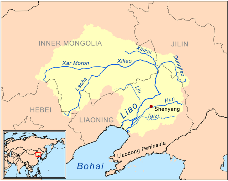
| current | 20:28, 9 March 2009 | | 1,000 × 793 (300 KB) | commons>Kmusser | {{Information |Description=This is a map of the Liao River drainage basin. |Source=Own work using [http://www.maproom.psu.edu/dcw/ Digital Chart of the World] and [http://edc.usgs.gov/products/elevation/gtopo30/gtopo30.html GTOPO] data. |
File usage
There are no pages that use this file.