File:Lago Menor o Huiñamarca Perú Bolivia Satelital map 68.85829W 16.png
Jump to navigation
Jump to search

Size of this preview: 800 × 556 pixels. Other resolutions: 320 × 222 pixels | 640 × 445 pixels | 1,024 × 711 pixels | 1,150 × 799 pixels.
Original file (1,150 × 799 pixels, file size: 1.52 MB, MIME type: image/png)
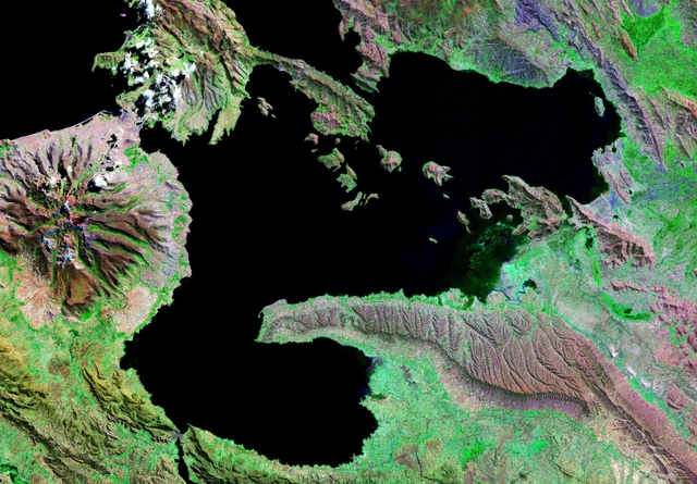
| Description | Imagen satelital del Lago Menor, (Lago Titicaca), compartidos por Perú y Bolivia. |
| Date | |
| Source | Nasa WorldWind |
| Author | Nasa |
| This image is in the public domain because it is a screenshot from NASA’s globe software World Wind using a public domain layer, such as Blue Marble, MODIS, Landsat, SRTM, USGS or GLOBE.
|
 |
File history
Click on a date/time to view the file as it appeared at that time.
| Date/Time | Thumbnail | Dimensions | User | Comment | |
|---|---|---|---|---|---|
| current | 21:28, 16 September 2007 | | 1,150 × 799 (1.52 MB) | commons>Paris88 | {{Information |Description=Imagen satelital del Lago Menor, (Lago Titicaca), compartidos por Perú y Bolivia. |Source= Nasa WorldWind |Date=16/09/2007 |Author= Nasa |Permission= see below |other_versions= }} {{PD-WorldWind}} Category:Bolivia |
File usage
There are no pages that use this file.