File:Kft B-L 1789.png
Jump to navigation
Jump to search
Size of this preview: 631 × 600 pixels. Other resolutions: 253 × 240 pixels | 505 × 480 pixels | 787 × 748 pixels.
Original file (787 × 748 pixels, file size: 440 KB, MIME type: image/png)
File history
Click on a date/time to view the file as it appeared at that time.
| Date/Time | Thumbnail | Dimensions | User | Comment | |
|---|---|---|---|---|---|
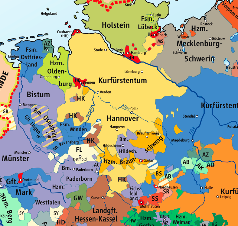
| current | 22:22, 8 November 2008 | | 787 × 748 (440 KB) | commons>Papa01~commonswiki | {{Information |Description=Karte des Kurfürstentums Braunschweig-Lüneburg 1789 / Map of the Electorate of Brunswick-Lüneburg 1789 |Source=Wikipedia/Source of Information: Putzger – Historischer Weltatlas, 89. Auflage, 1965 |Date=2007-02-25 |Author=k |
File usage
There are no pages that use this file.