File:Kazakhstan 2001 CIA map.jpg
Original file (1,944 × 1,940 pixels, file size: 1.73 MB, MIME type: image/jpeg)
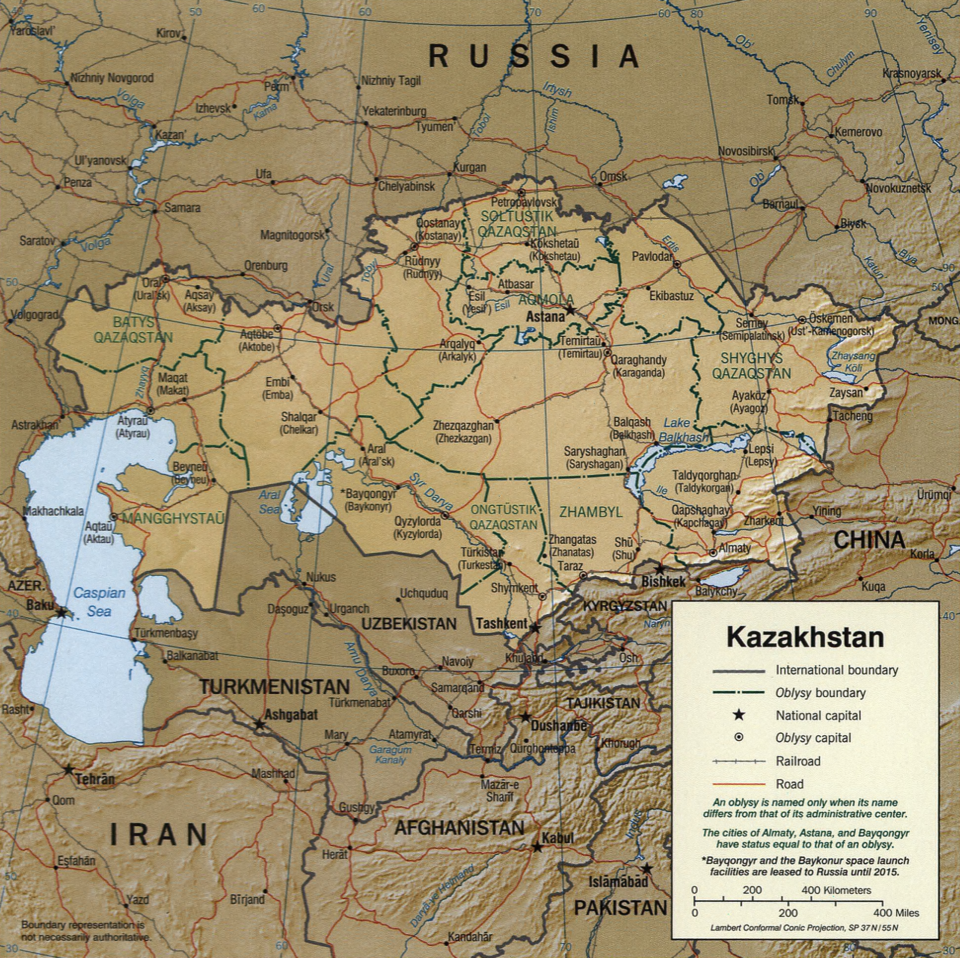
Kazakhstan.
United States. Central Intelligence Agency.
CREATED/PUBLISHED [Washington, D.C. : Central Intelligence Agency, 2001]
NOTES Relief shown by shading.
"Base 802516AI (C00217) 12-01".
Also shows primary administrative divisions.
Also separately issued without shaded relief.
Includes notes.
Scale [ca. 1:20,000,000] ; Lambert conformal conic proj., SP 370N/550N (E 460--E 870/N 550--N 410).
SUBJECTS Kazakhstan--Maps. Kazakhstan.
MEDIUM 1 map : col. ; 17 x 17 cm.
CALL NUMBER G7220 2001 .U6
REPOSITORY Library of Congress Geography and Map Division Washington, D.C. 20540-4650 USA
DIGITAL ID g7220 ct000977 http://hdl.loc.gov/loc.gmd/g7220.ct000977
| This image is a work of a Central Intelligence Agency employee, taken or made as part of that person's official duties. As a Work of the United States Government, this image or media is in the public domain in the United States.
|

|
File history
Click on a date/time to view the file as it appeared at that time.
| Date/Time | Thumbnail | Dimensions | User | Comment | |
|---|---|---|---|---|---|
| current | 16:17, 8 April 2013 | | 1,944 × 1,940 (1.73 MB) | commons>Ras67 | losslessly cropped with Jpegcrop |
File usage
There are no pages that use this file.