File:Karte westwall.png
Jump to navigation
Jump to search
Size of this preview: 345 × 600 pixels. Other resolutions: 138 × 240 pixels | 276 × 480 pixels.
Original file (800 × 1,391 pixels, file size: 161 KB, MIME type: image/png)
File history
Click on a date/time to view the file as it appeared at that time.
| Date/Time | Thumbnail | Dimensions | User | Comment | |
|---|---|---|---|---|---|
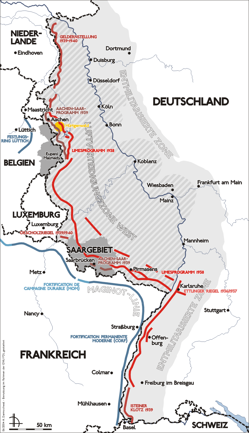
| current | 10:15, 17 September 2005 | | 800 × 1,391 (161 KB) | commons>Saperaud~commonswiki | *Darstellung zeigt Lage, Verlauf und bauliche Entwicklung des Westwalls. *Zeichnung erstellt 2004 von Benutzer:Sansculotte. Bild ist unter der GNU FDL zur weiteren Verwendung freigegeben. *'''Quellenangabe und Beleg an [mailto:sansculotte@despamme |
File usage
There are no pages that use this file.