File:Karta ID Maluku isl.PNG
Jump to navigation
Jump to search
No higher resolution available.
Karta_ID_Maluku_isl.PNG (348 × 348 pixels, file size: 4 KB, MIME type: image/png)
Summary
| Description |
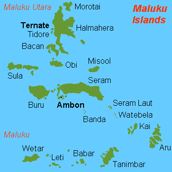
English: Map (rough) of Maluku islands, Indonesia, own work composed from various mapreferences |
| Date | |
| Source | Own work |
| Author | Hobe / Holger Behr |
| Other versions | Derivative works of this file: Maluku Islands international.png |
Licensing
| I, the copyright holder of this work, release this work into the public domain. This applies worldwide. In some countries this may not be legally possible; if so: I grant anyone the right to use this work for any purpose, without any conditions, unless such conditions are required by law. |
-
File history
Click on a date/time to view the file as it appeared at that time.
| Date/Time | Thumbnail | Dimensions | User | Comment | |
|---|---|---|---|---|---|
| current | 13:50, 26 February 2018 | | 348 × 348 (4 KB) | commons>Sebastian Wallroth | Removed border by cropping 1 % horizontally and 1 % vertically using CropTool with precise mode. |
File usage
There are no pages that use this file.