File:Kapoho Bay lava 20180604.jpg
Jump to navigation
Jump to search
Size of this preview: 800 × 450 pixels. Other resolutions: 320 × 180 pixels | 640 × 360 pixels | 1,024 × 576 pixels | 1,280 × 720 pixels | 3,412 × 1,920 pixels.
Original file (3,412 × 1,920 pixels, file size: 4.18 MB, MIME type: image/jpeg)
Summary
| Description |
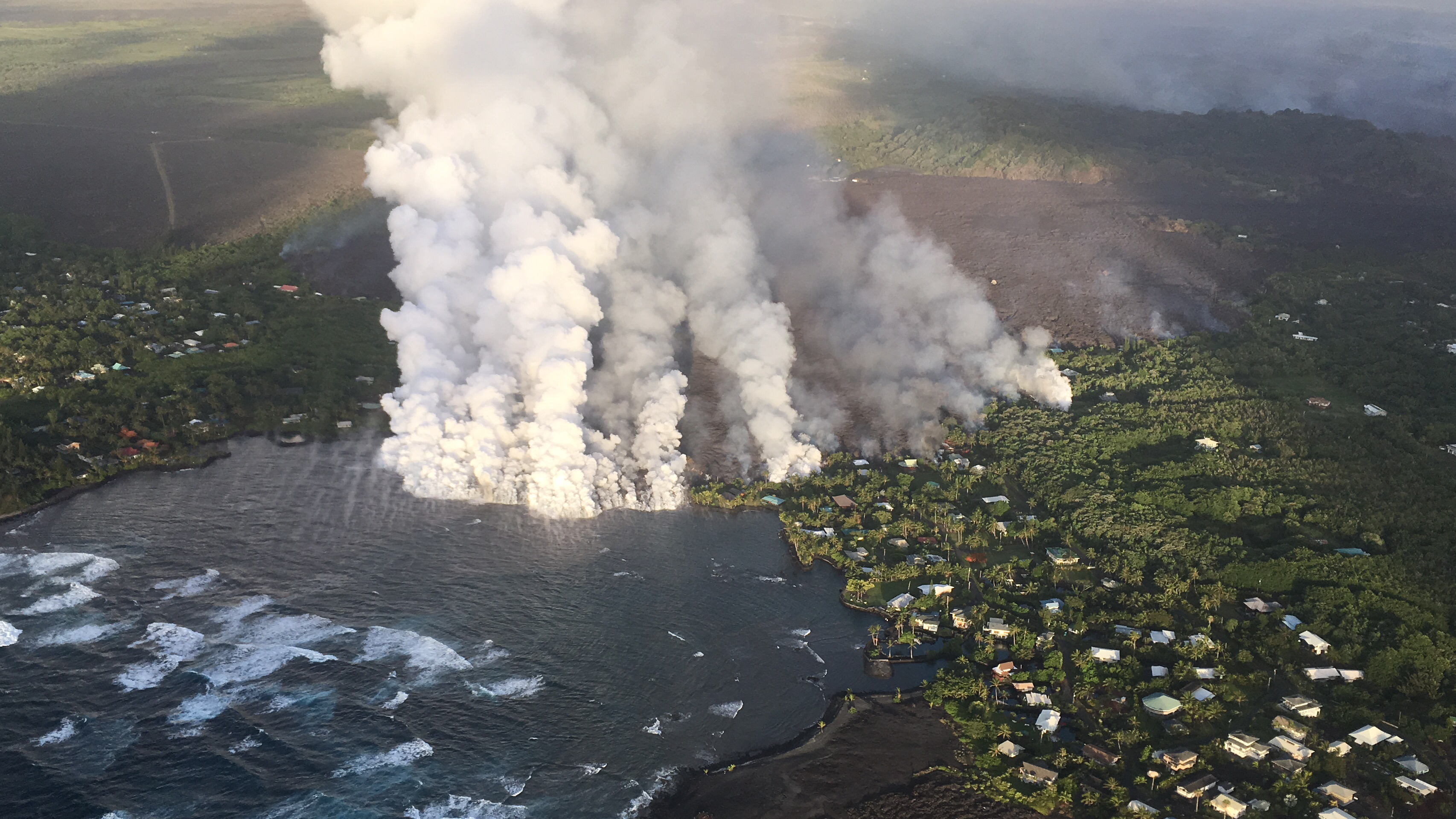
English: On June 4, 2018, a channel of lava from a fissure ten miles inland cut through the homes of Kapoho Beach Lots and Vacationland, and began to fill in the tide pools of Kapoho Bay. |
| Date | |
| Source | https://volcanoes.usgs.gov/volcanoes/kilauea/multimedia_chronology.html (USGS-HVO) |
| Author | US Geological Survey |
Licensing
This image is in the public domain in the United States because it only contains materials that originally came from the United States Geological Survey, an agency of the United States Department of the Interior. For more information, see the official USGS copyright policy.
|
File history
Click on a date/time to view the file as it appeared at that time.
| Date/Time | Thumbnail | Dimensions | User | Comment | |
|---|---|---|---|---|---|
| current | 03:17, 8 June 2018 | | 3,412 × 1,920 (4.18 MB) | commons>Jeff the quiet | {{Information |description ={{en|1=On June 4, 2018, a channel of lava from a fissure ten miles inland cut through the homes of Kapoho Beach Lots and Vacationland, and began to fill in the tide pools of Kapoho Bay.}} |source =https://volcanoes.usgs.gov/volcanoes/kilauea/multimedia_chronology.html (USGS-HVO) |author =US Geological Survey |date =2018-06-04 }} Category:Lava Category:Kapoho, Hawaii Category:Tide pools |
File usage
There are no pages that use this file.