File:Japan Relief Map of Land and Seabed.png
Jump to navigation
Jump to search
Size of this preview: 727 × 599 pixels. Other resolutions: 291 × 240 pixels | 582 × 480 pixels | 932 × 768 pixels | 1,242 × 1,024 pixels | 2,117 × 1,745 pixels.
Original file (2,117 × 1,745 pixels, file size: 7.47 MB, MIME type: image/png)
File history
Click on a date/time to view the file as it appeared at that time.
| Date/Time | Thumbnail | Dimensions | User | Comment | |
|---|---|---|---|---|---|
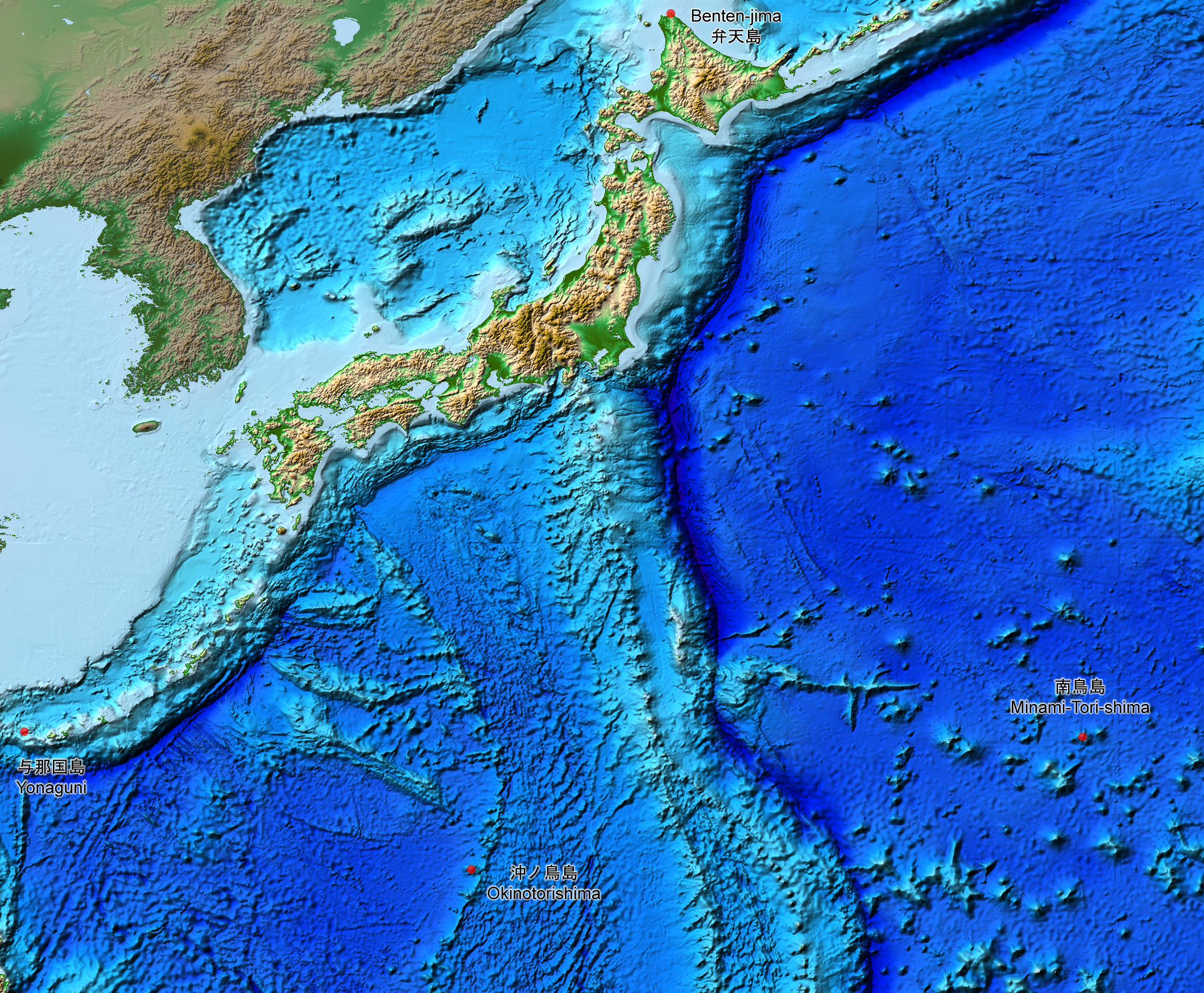
| current | 15:07, 5 August 2019 | | 2,117 × 1,745 (7.47 MB) | commons>Artanisen | The continent geography is darker to highlight the Japanese archipelago. |
File usage
There are no pages that use this file.