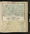
File:Jamestown and Lime Township Plat Maps from the Standard Atlas, Blue Earth County, Minnesota.jpg
Jump to navigation
Jump to search

Size of this preview: 529 × 600 pixels. Other resolutions: 212 × 240 pixels | 423 × 480 pixels | 1,000 × 1,134 pixels.
Original file (1,000 × 1,134 pixels, file size: 223 KB, MIME type: image/jpeg)
File history
Click on a date/time to view the file as it appeared at that time.
| Date/Time | Thumbnail | Dimensions | User | Comment | |
|---|---|---|---|---|---|
| current | 19:47, 15 June 2023 |  | 1,000 × 1,134 (223 KB) | commons>BECHSArchives | Uploaded a work by Geo. A. Ogle & Co., Publishers and Engravers from https://collection.mndigital.org/catalog/blue:2337#?c=&m=&s=&cv=47&xywh=-1700%2C-324%2C8531%2C6471 with UploadWizard |
File usage
There are no pages that use this file.