File:India Bangladesh border US Army Map Service.jpg
Jump to navigation
Jump to search

Size of this preview: 517 × 599 pixels. Other resolutions: 207 × 240 pixels | 414 × 480 pixels | 680 × 788 pixels.
Original file (680 × 788 pixels, file size: 288 KB, MIME type: image/jpeg)
File history
Click on a date/time to view the file as it appeared at that time.
| Date/Time | Thumbnail | Dimensions | User | Comment | |
|---|---|---|---|---|---|
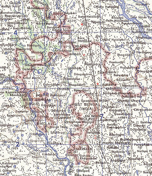
| current | 10:31, 14 May 2007 | | 680 × 788 (288 KB) | commons>Roke~commonswiki | Map of the India-Bangladesh border, US army map service, 1960s. Shows some of the enclaves on the border, but is simplified. {{PD-PCL|txu-oclc-6614190-ng45-8.jpg|/ams/india/}} Category:Maps of India Category:Maps of Bangladesh |
File usage
There are no pages that use this file.