File:Ice Peak Formation.png
Jump to navigation
Jump to search

Size of this preview: 414 × 599 pixels. Other resolutions: 166 × 240 pixels | 442 × 640 pixels.
Original file (442 × 640 pixels, file size: 16 KB, MIME type: image/png)
File history
Click on a date/time to view the file as it appeared at that time.
| Date/Time | Thumbnail | Dimensions | User | Comment | |
|---|---|---|---|---|---|
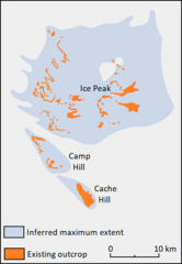
| current | 23:16, 3 June 2024 | | 442 × 640 (16 KB) | commons>Volcanoguy | {{Information |Description=Geological map of the Ice Peak Formation in British Columbia, Canada. |Source={{own}} based on a geological map in ''The Late Cenozoic Mount Edziza Volcanic Complex, British Columbia'' (p. 146) |Date= 2024-06-03 |Author= Volcanoguy |Permission= |other_versions= }} Category:Mount Edziza volcanic complex Category:Maps of geologic formations in Canada |
File usage
There are no pages that use this file.