File:Holloway, Chanctonbury Ring Road - geograph.org.uk - 149405.jpg
Jump to navigation
Jump to search
Size of this preview: 449 × 600 pixels. Other resolutions: 179 × 240 pixels | 479 × 640 pixels.
Original file (479 × 640 pixels, file size: 183 KB, MIME type: image/jpeg)
File history
Click on a date/time to view the file as it appeared at that time.
| Date/Time | Thumbnail | Dimensions | User | Comment | |
|---|---|---|---|---|---|
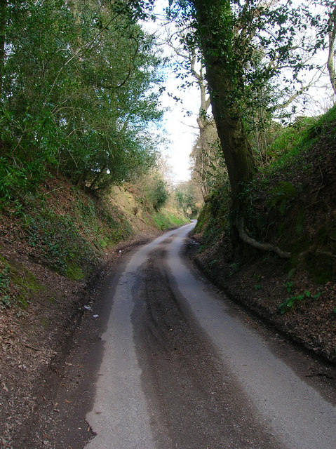
| current | 07:24, 31 January 2010 | | 479 × 640 (183 KB) | commons>GeographBot | == {{int:filedesc}} == {{Information |description={{en|1=Holloway, Chanctonbury Ring Road. An old droving lane that linked Downland farms with their Wealden pastures.}} |date=2006-04-09 |source=From [http://www.geograph.org.uk/photo/149405 geograph.org.uk |
File usage
There are no pages that use this file.