File:Highway 2 and 53 Split approaching Ancaster.png
Jump to navigation
Jump to search

Size of this preview: 605 × 600 pixels. Other resolutions: 242 × 240 pixels | 484 × 480 pixels | 775 × 768 pixels | 1,033 × 1,024 pixels | 2,470 × 2,448 pixels.
Original file (2,470 × 2,448 pixels, file size: 6.33 MB, MIME type: image/png)
Summary
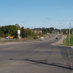
| Description | Facing east towards split between former Ontario Highway 2 and Highway 53 southwest of Ancaster |
| Date | |
| Source | Own work by the original uploader |
| Author | ʄɭoʏɗiaɲ τ ¢ |
Licensing
This file is licensed under the Creative Commons Attribution-Share Alike 3.0 Unported license.
- You are free:
- to share – to copy, distribute and transmit the work
- to remix – to adapt the work
- Under the following conditions:
- attribution – You must give appropriate credit, provide a link to the license, and indicate if changes were made. You may do so in any reasonable manner, but not in any way that suggests the licensor endorses you or your use.
- share alike – If you remix, transform, or build upon the material, you must distribute your contributions under the same or compatible license as the original.
Original upload log
Transferred from en.wikipedia to Commons by XXN. All following user names refer to en.wikipedia.
| Date/Time | User | Resolution | Size | Edit summary |
|---|---|---|---|---|
| 2011-10-03T01:27:08Z | Floydian | 2470×2448 | 6636934 | {{Information |Description=Facing east towards split between former [[Ontario Highway 2]] and [[Ontario Highway 53|Highway 53]] southwest of [[Ancaster, Ontario|Ancaster]] |Source={{Own work by original uploader}} |Date=October 1, 2011 |Author=~~~ |Permission= |other_versions= }} |
File history
Click on a date/time to view the file as it appeared at that time.
| Date/Time | Thumbnail | Dimensions | User | Comment | |
|---|---|---|---|---|---|
| current | 21:50, 20 October 2016 | | 2,470 × 2,448 (6.33 MB) | commons>XXN | {{Information |Description=Facing east towards split between former Ontario Highway 2 and Highway 53 southwest of Ancaster |Source={{Own work by original uploader}} |Date=October 1, 2011 |Author='''[[:en... |
File usage
There are no pages that use this file.