File:Havana Map - La Víbora (Diez de Octubre).png
Jump to navigation
Jump to search

Size of this preview: 800 × 445 pixels. Other resolutions: 320 × 178 pixels | 640 × 356 pixels | 1,280 × 712 pixels.
Original file (1,280 × 712 pixels, file size: 207 KB, MIME type: image/png)
.png)
File history
Click on a date/time to view the file as it appeared at that time.
| Date/Time | Thumbnail | Dimensions | User | Comment | |
|---|---|---|---|---|---|
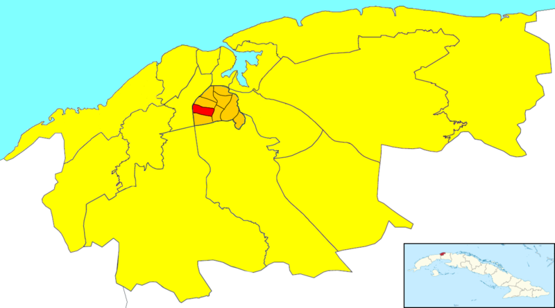
| current | 01:08, 25 August 2022 | | 1,280 × 712 (207 KB) | commons>CubanoBoi | Uploaded a work by '''Dэя-Бøяg''' from Locator map of the ward of La Víbora (shown in red) within the municipal borough of Diez de Octubre (orange) and the city of Havana (yellow). The little Cuban map in the corner shows Havana (dark red) within the island. Note: to obtain the borders of Playa I followed the photo on CubaDebate. http://www.cubadebate.cu/especiales/2019/10/13/cuba-contra-el-bloqueo-poesia-de-lo-cotidiano/amp/ with UploadWizard |
File usage
There are no pages that use this file.
.png)