File:Hamilton Air Force aerial view.jpg
Jump to navigation
Jump to search

Size of this preview: 800 × 534 pixels. Other resolutions: 320 × 214 pixels | 640 × 427 pixels | 1,024 × 683 pixels | 1,500 × 1,001 pixels.
Original file (1,500 × 1,001 pixels, file size: 645 KB, MIME type: image/jpeg)
| Description |
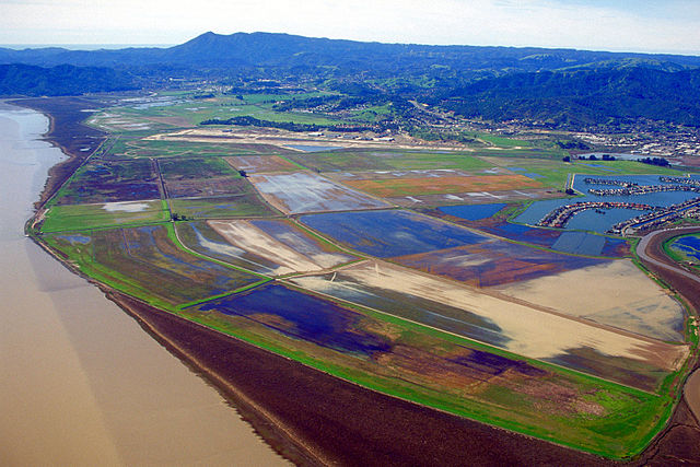
English: Aerial view to the south-southwest of the former Hamilton Air Force Base in Novato, Marin County, California. The base was closed as an U.S. Air Force base in 1974 and sold by the U.S. Government in 1988. The old runway is still visible in the distance.
Coordinates: 38°4′5.63″N 122°30′6.66″W / 38.0682306°N 122.50185°W
|
|||
| Location | Novato, California, USA | |||
| Date | not specified or unknown | |||
| Source |
U.S. Army Corps of Engineers Digital Visual Library Image page Image description page Digital Visual Library home page |
|||
| Author | U.S. Army Corps of Engineers, photographer not specified or unknown | |||
| Permission (Reusing this file) |
|
File history
Click on a date/time to view the file as it appeared at that time.
| Date/Time | Thumbnail | Dimensions | User | Comment | |
|---|---|---|---|---|---|
| current | 04:34, 4 May 2007 | | 1,500 × 1,001 (645 KB) | commons>DanMS | {{Information | Description = {{en|Aerial view of the former Hamilton Air Force Base in Novato, California, USA. The base was closed as an U.S. Air Force base in 1974 and sold by the U.S. Government in 1988. The old runway is still visible in the dista |
File usage
There are no pages that use this file.