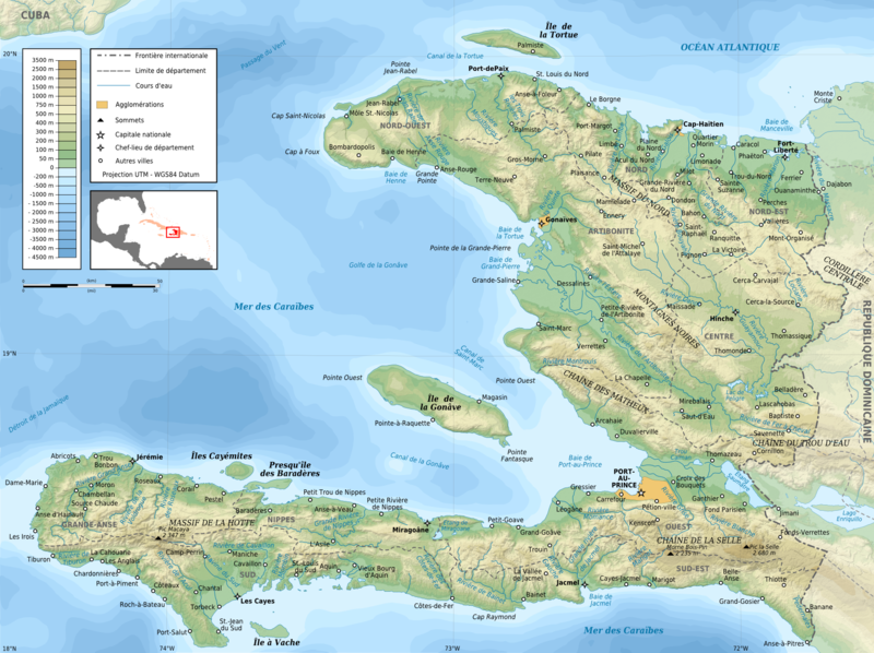
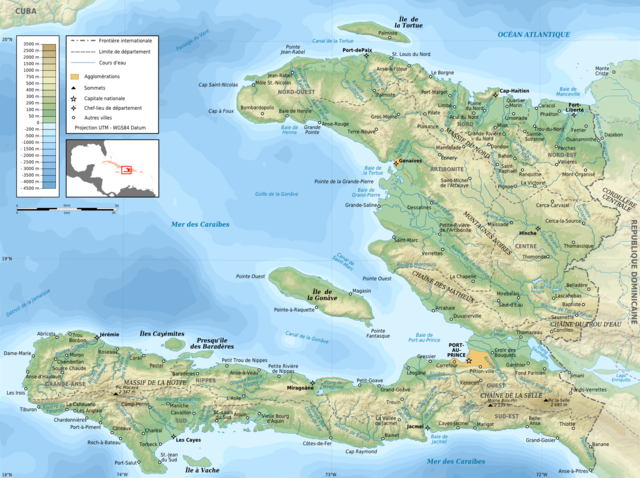
File:Haiti topographic map-fr.png
Jump to navigation
Jump to search

Size of this preview: 800 × 598 pixels. Other resolutions: 320 × 239 pixels | 640 × 478 pixels | 1,024 × 765 pixels | 1,280 × 956 pixels | 1,739 × 1,299 pixels.
Original file (1,739 × 1,299 pixels, file size: 2.21 MB, MIME type: image/png)
File history
Click on a date/time to view the file as it appeared at that time.
| Date/Time | Thumbnail | Dimensions | User | Comment | |
|---|---|---|---|---|---|
| current | 19:26, 11 March 2009 | | 1,739 × 1,299 (2.21 MB) | commons>Korrigan | + masque blanc pour pays étrangers |
File usage
There are no pages that use this file.