File:Haiti departements map-fr.svg
Jump to navigation
Jump to search

Size of this PNG preview of this SVG file: 800 × 598 pixels. Other resolutions: 320 × 239 pixels | 640 × 478 pixels | 1,024 × 765 pixels | 1,280 × 956 pixels | 2,560 × 1,912 pixels | 1,739 × 1,299 pixels.
Original file (SVG file, nominally 1,739 × 1,299 pixels, file size: 335 KB)
File history
Click on a date/time to view the file as it appeared at that time.
| Date/Time | Thumbnail | Dimensions | User | Comment | |
|---|---|---|---|---|---|
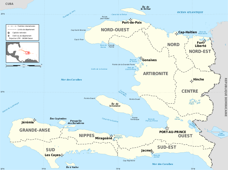
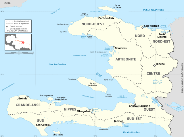
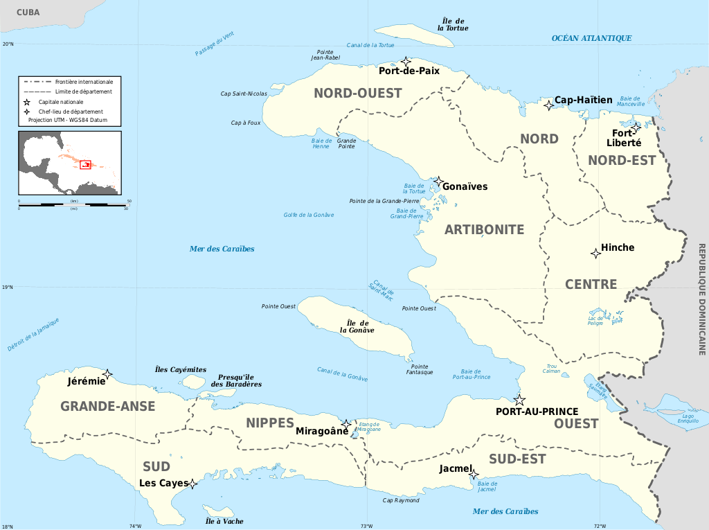
| current | 18:25, 12 March 2009 | | 1,739 × 1,299 (335 KB) | commons>Korrigan | {{Information |Description={{en|Map of the ''départements'' of Haiti in French.}} {{fr|Carte des départements d'Haïti en français.}} * UTM projection, WGS84 datum |Source=Own work. Sources of data: * NASA [ftp://e0srp01u.ecs.nasa.gov/srtm/version2 |
File usage
There are no pages that use this file.