File:Ground Plan of the Royal Fort, Bristol, 1644.jpg
Jump to navigation
Jump to search

Size of this preview: 800 × 596 pixels. Other resolutions: 320 × 238 pixels | 640 × 476 pixels | 1,024 × 762 pixels | 1,280 × 953 pixels | 1,428 × 1,063 pixels.
Original file (1,428 × 1,063 pixels, file size: 1 MB, MIME type: image/jpeg)
File history
Click on a date/time to view the file as it appeared at that time.
| Date/Time | Thumbnail | Dimensions | User | Comment | |
|---|---|---|---|---|---|
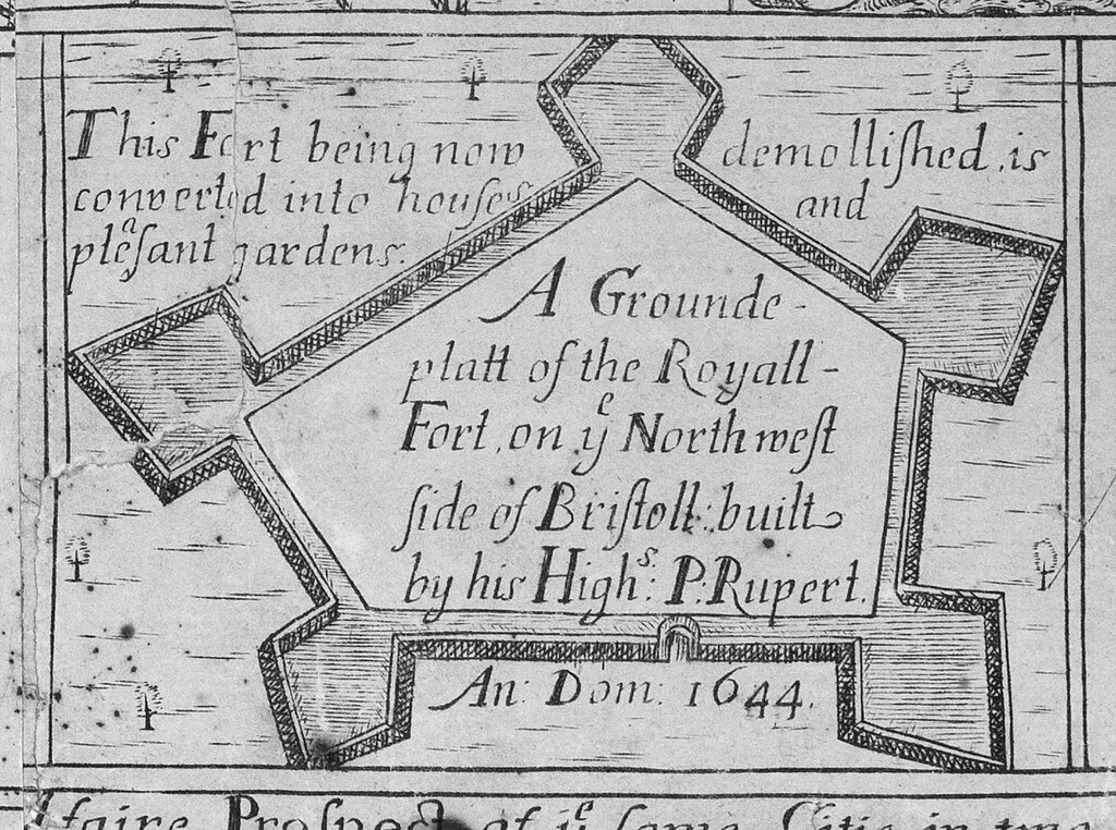
| current | 14:27, 17 June 2023 | | 1,428 × 1,063 (1 MB) | commons>Evan T Jones | Uploaded a work by James Millerd from Detail from the 1728 updated edition of James Millerd's map 'An Exact Delineation of the Famous Citty of Bristoll and Suburbs', first published in 1673. with UploadWizard |
File usage
There are no pages that use this file.