File:Great Ouse Relief Channel.jpg
Jump to navigation
Jump to search

Size of this preview: 800 × 600 pixels. Other resolutions: 320 × 240 pixels | 640 × 480 pixels | 1,024 × 768 pixels | 1,280 × 960 pixels | 2,560 × 1,920 pixels.
Original file (2,560 × 1,920 pixels, file size: 400 KB, MIME type: image/jpeg)
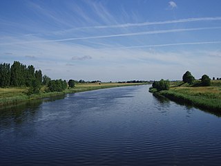
| Description | The River Great Ouse relief channel, a "6½ mile navigable channel from a lock at Denver Sluice to Wiggenhall Bridge just over two miles south of King's Lynn." (more information). This photo was taken from the disused railway bridge near Wiggenhall St. Mary Magdalen (Norfolk) which crosses it. |
| Date | some time last month |
| Source | Own work |
| Author | Lewis Collard |
| Camera location | | View this and other nearby images on: OpenStreetMap |
|---|

|
The copyright holder of this file, Lewis Collard, allows anyone to use it for any purpose, provided that the copyright holder is properly attributed. Redistribution, derivative work, commercial use, and all other use is permitted. |
Attribution:
Lewis Collard
|
File history
Click on a date/time to view the file as it appeared at that time.
| Date/Time | Thumbnail | Dimensions | User | Comment | |
|---|---|---|---|---|---|
| current | 12:48, 19 August 2007 | | 2,560 × 1,920 (400 KB) | commons>Collard | {{Information |Description=The River Great Ouse relief channel, a "6½ mile navigable channel from a lock at Denver Sluice to Wiggenhall Bridge just over two miles south of King's Lynn." ([http://www.jim-shead.com/waterways/Old-Bedford-River.html#GORC mor |
File usage
There are no pages that use this file.