File:Golan Heights Map.PNG
Jump to navigation
Jump to search
No higher resolution available.
Golan_Heights_Map.PNG (415 × 354 pixels, file size: 19 KB, MIME type: image/png)
File history
Click on a date/time to view the file as it appeared at that time.
| Date/Time | Thumbnail | Dimensions | User | Comment | |
|---|---|---|---|---|---|
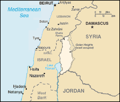
| current | 20:58, 28 June 2005 | | 415 × 354 (19 KB) | commons>Quadell | A map of the Golan Heights, made entirely of info from the CIA World Factbook. If this is even elligible for copyright, I hereby release it into the public domain. {{PD-USGov-CIA-WF}} Category:Maps of Israel Category:Maps of Syria |
File usage
There are no pages that use this file.