File:Frankfurt airport hub map v2.png
Jump to navigation
Jump to search

Size of this preview: 764 × 600 pixels. Other resolutions: 306 × 240 pixels | 612 × 480 pixels | 979 × 768 pixels | 1,158 × 909 pixels.
Original file (1,158 × 909 pixels, file size: 1.03 MB, MIME type: image/png)
File history
Click on a date/time to view the file as it appeared at that time.
| Date/Time | Thumbnail | Dimensions | User | Comment | |
|---|---|---|---|---|---|
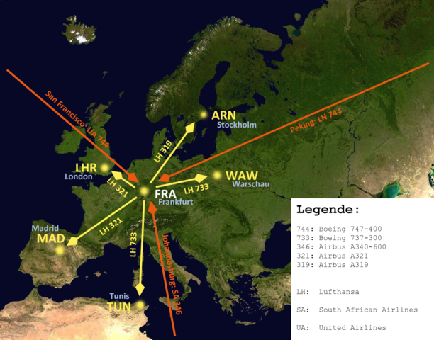
| current | 11:03, 11 December 2008 | | 1,158 × 909 (1.03 MB) | commons>Upon a tree | {{Information |Description={{en|1=A map of Europe to show how an airport-hub is working. Using the example of Lufthansa based in FRA/EDDF. I added some common routes and common aircraft types, flying this route. For bether understanding I added a caption. |
File usage
There are no pages that use this file.