File:Europe topography ECRIS.png
Jump to navigation
Jump to search

Size of this preview: 624 × 599 pixels. Other resolutions: 250 × 240 pixels | 500 × 480 pixels | 800 × 768 pixels | 1,066 × 1,024 pixels | 2,355 × 2,262 pixels.
Original file (2,355 × 2,262 pixels, file size: 1,005 KB, MIME type: image/png)
File history
Click on a date/time to view the file as it appeared at that time.
| Date/Time | Thumbnail | Dimensions | User | Comment | |
|---|---|---|---|---|---|
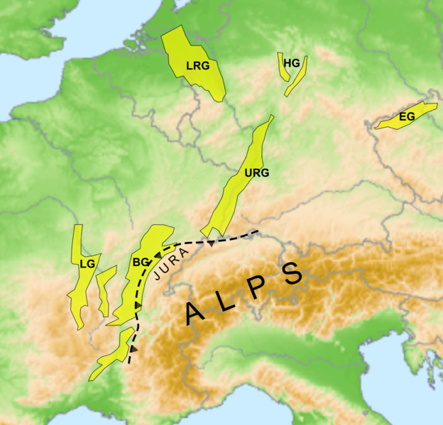
| current | 14:59, 2 June 2010 | | 2,355 × 2,262 (1,005 KB) | commons>Mikenorton | {{Information |Description=* Description:Location of European Cenozoic Rift System * Source: own map, based on the [http://gmt.soest.hawaii.edu/ Generic Mapping Tools] and [http://dss.ucar.edu/datasets/ds759.3/ ETOPO2] * Author: San Jose |
File usage
There are no pages that use this file.