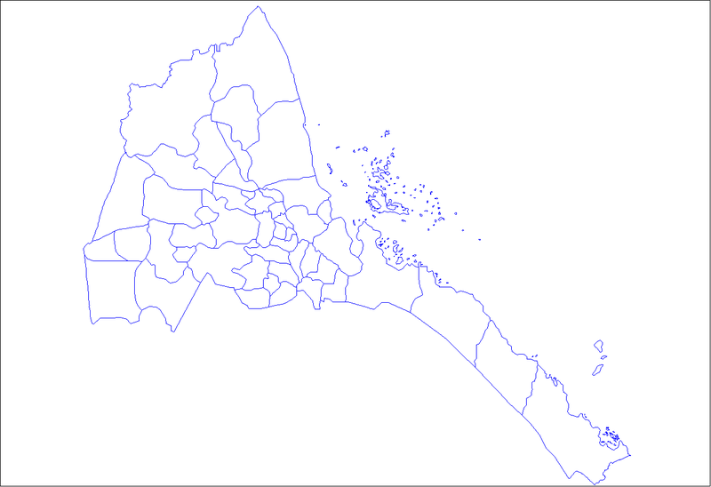
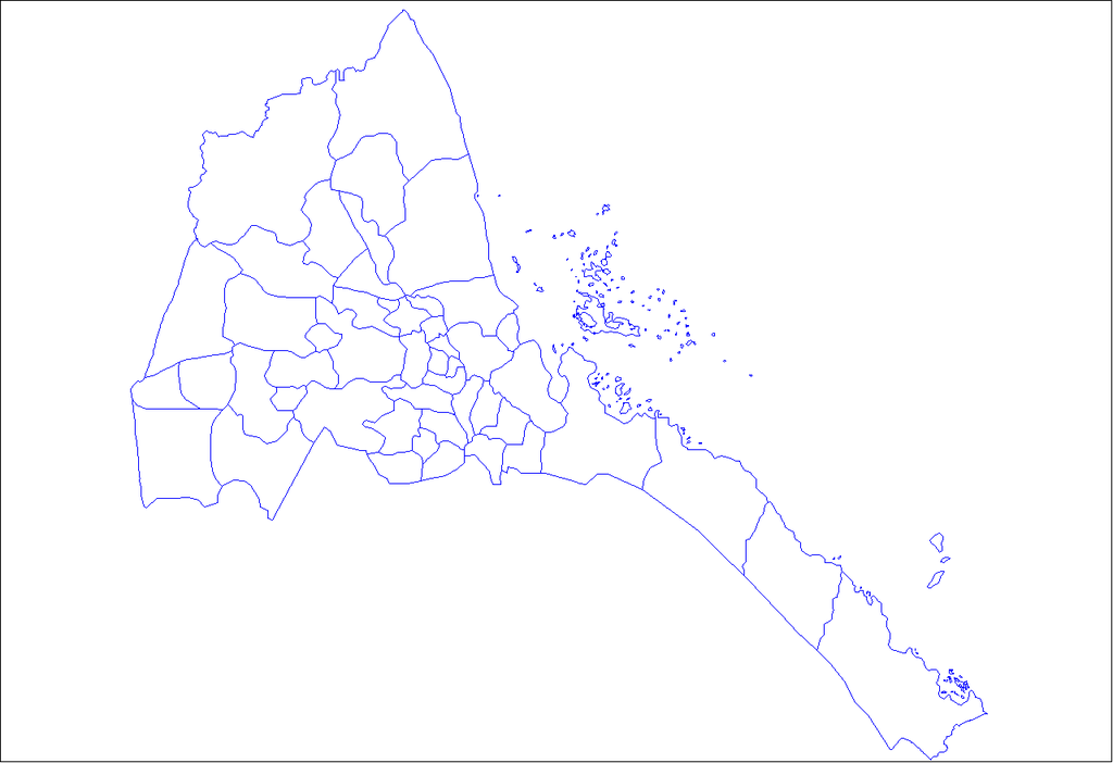
File:Eritrea districts.png
Jump to navigation
Jump to search

Size of this preview: 800 × 548 pixels. Other resolutions: 320 × 219 pixels | 640 × 439 pixels | 1,024 × 702 pixels | 1,281 × 878 pixels.
Original file (1,281 × 878 pixels, file size: 20 KB, MIME type: image/png)
File history
Click on a date/time to view the file as it appeared at that time.
| Date/Time | Thumbnail | Dimensions | User | Comment | |
|---|---|---|---|---|---|
| current | 19:03, 11 April 2007 | | 1,281 × 878 (20 KB) | commons>Rarelibra | Map of the districts of Eritrea. Created by ~~~~ for public domain use, using MapInfo Professional v8.5 and various mapping resources. |
File usage
There are no pages that use this file.