File:Equatorialguineamap.png
Jump to navigation
Jump to search
No higher resolution available.
Equatorialguineamap.png (728 × 496 pixels, file size: 236 KB, MIME type: image/png)
File history
Click on a date/time to view the file as it appeared at that time.
| Date/Time | Thumbnail | Dimensions | User | Comment | |
|---|---|---|---|---|---|
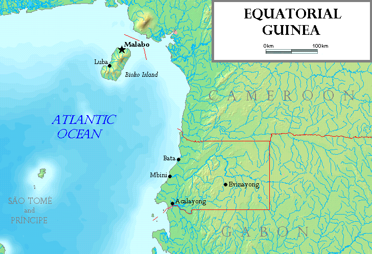
| current | 18:51, 18 July 2006 | | 728 × 496 (236 KB) | commons>Tonym88~commonswiki | Map of Equatorial Guinea, made by the uploader. Based on a map from http://www.demis.nl/wms/mapclip.htm. The island of Annobón is not shown. == Licensing == {{self2|GFDL|cc-by-sa-2.5,2.0,1.0}} {{demis-pd}} Category:Equatorial Guinea [[Category:Map |
File usage
There are no pages that use this file.