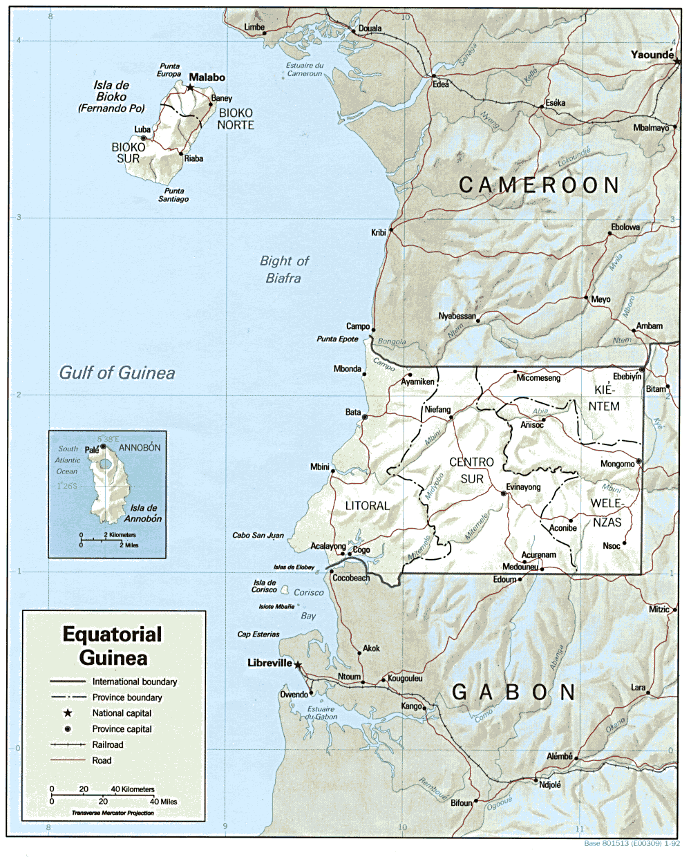
File:Equatorial Guinea Map.png
Jump to navigation
Jump to search
Size of this preview: 483 × 599 pixels. Other resolutions: 193 × 240 pixels | 387 × 480 pixels | 1,000 × 1,240 pixels.
Original file (1,000 × 1,240 pixels, file size: 264 KB, MIME type: image/png)
File history
Click on a date/time to view the file as it appeared at that time.
| Date/Time | Thumbnail | Dimensions | User | Comment | |
|---|---|---|---|---|---|
| current | 11:00, 22 February 2006 | | 1,000 × 1,240 (264 KB) | commons>Lupo | Shaded relief map of Equatorial Guinea. Source: [http://www.lib.utexas.edu/maps/africa/equatorial_guinea.gif] from the [http://www.lib.utexas.edu/maps/equatorial_guinea.html Perry-Castañeda Library Map Collection]. {{PD-USGov-CIA}} [[Category:Maps |
File usage
There are no pages that use this file.