File:Emin pasha relief expedition map 1890.png
Jump to navigation
Jump to search
Size of this preview: 800 × 576 pixels. Other resolutions: 320 × 231 pixels | 640 × 461 pixels | 1,002 × 722 pixels.
Original file (1,002 × 722 pixels, file size: 1.41 MB, MIME type: image/png)
File history
Click on a date/time to view the file as it appeared at that time.
| Date/Time | Thumbnail | Dimensions | User | Comment | |
|---|---|---|---|---|---|
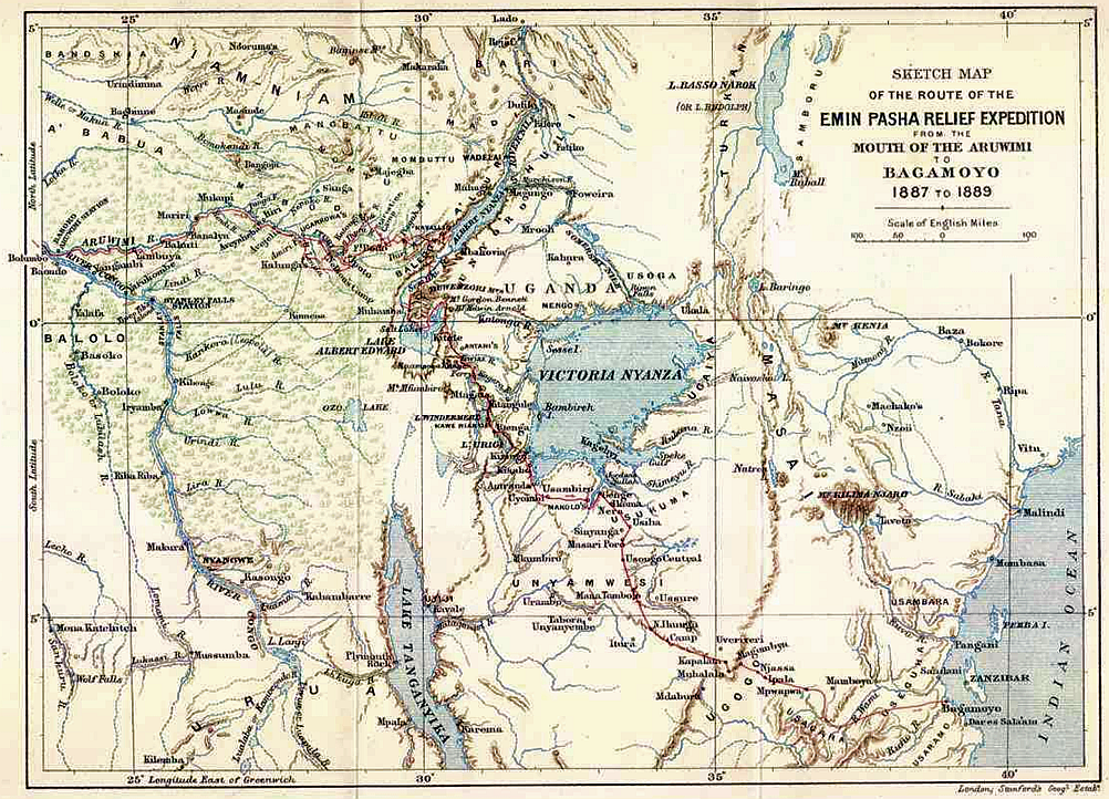
| current | 21:19, 24 August 2011 | | 1,002 × 722 (1.41 MB) | commons>Hans Erren | {{Information |Description ={{en|1=Map depicting the Route of H.M. Stanley to rescue Emin Pasha}} |Source =printed map of 1890 Royal Geographical Society |Author =H.M. Stanley |Date =1890 |Permission = |other_versions = }} |
File usage
There are no pages that use this file.