File:Ellendalemap1906.jpg
Jump to navigation
Jump to search
Size of this preview: 775 × 599 pixels. Other resolutions: 310 × 240 pixels | 621 × 480 pixels | 936 × 724 pixels.
Original file (936 × 724 pixels, file size: 110 KB, MIME type: image/jpeg)
File history
Click on a date/time to view the file as it appeared at that time.
| Date/Time | Thumbnail | Dimensions | User | Comment | |
|---|---|---|---|---|---|
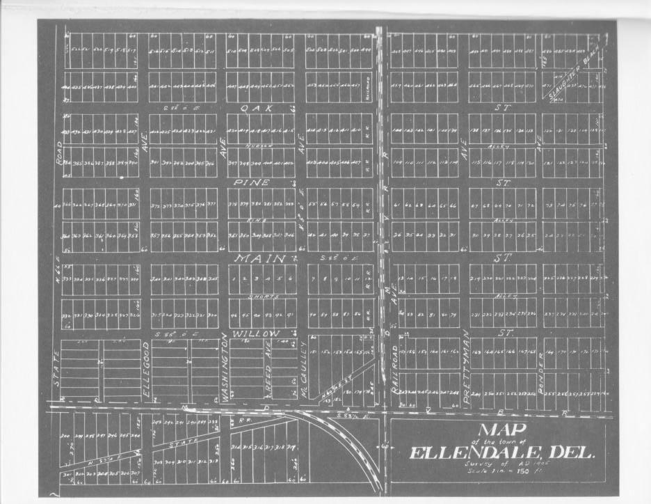
| current | 22:36, 14 March 2008 | | 936 × 724 (110 KB) | commons>Electrikpimp | {{Information |Description= Map of the town of Ellendale, Delaware as planners laid it out in 1906. |Source= http://stateplanning.delaware.gov/comp_plans/ellendale_illustrations_maps.pdf |Date= |Author= |Permission= Map is from 1906, as indicated on map |
File usage
There are no pages that use this file.