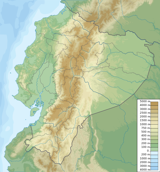
File:Ecuador relief location map.svg
Jump to navigation
Jump to search

Size of this PNG preview of this SVG file: 556 × 599 pixels. Other resolutions: 223 × 240 pixels | 445 × 480 pixels | 713 × 768 pixels | 950 × 1,024 pixels | 1,901 × 2,048 pixels | 851 × 917 pixels.
Original file (SVG file, nominally 851 × 917 pixels, file size: 3.76 MB)
File history
Click on a date/time to view the file as it appeared at that time.
| Date/Time | Thumbnail | Dimensions | User | Comment | |
|---|---|---|---|---|---|
| current | 19:49, 15 October 2012 | | 851 × 917 (3.76 MB) | commons>Milenioscuro | corrections of coastal line and boundaries (according to Ecuador location map.svg) |
File usage
There are no pages that use this file.