File:EasternVirginia1775.jpg
Jump to navigation
Jump to search

Size of this preview: 757 × 599 pixels. Other resolutions: 303 × 240 pixels | 606 × 480 pixels | 970 × 768 pixels | 1,280 × 1,013 pixels | 2,560 × 2,027 pixels | 3,360 × 2,660 pixels.
Original file (3,360 × 2,660 pixels, file size: 2.84 MB, MIME type: image/jpeg)
File history
Click on a date/time to view the file as it appeared at that time.
| Date/Time | Thumbnail | Dimensions | User | Comment | |
|---|---|---|---|---|---|
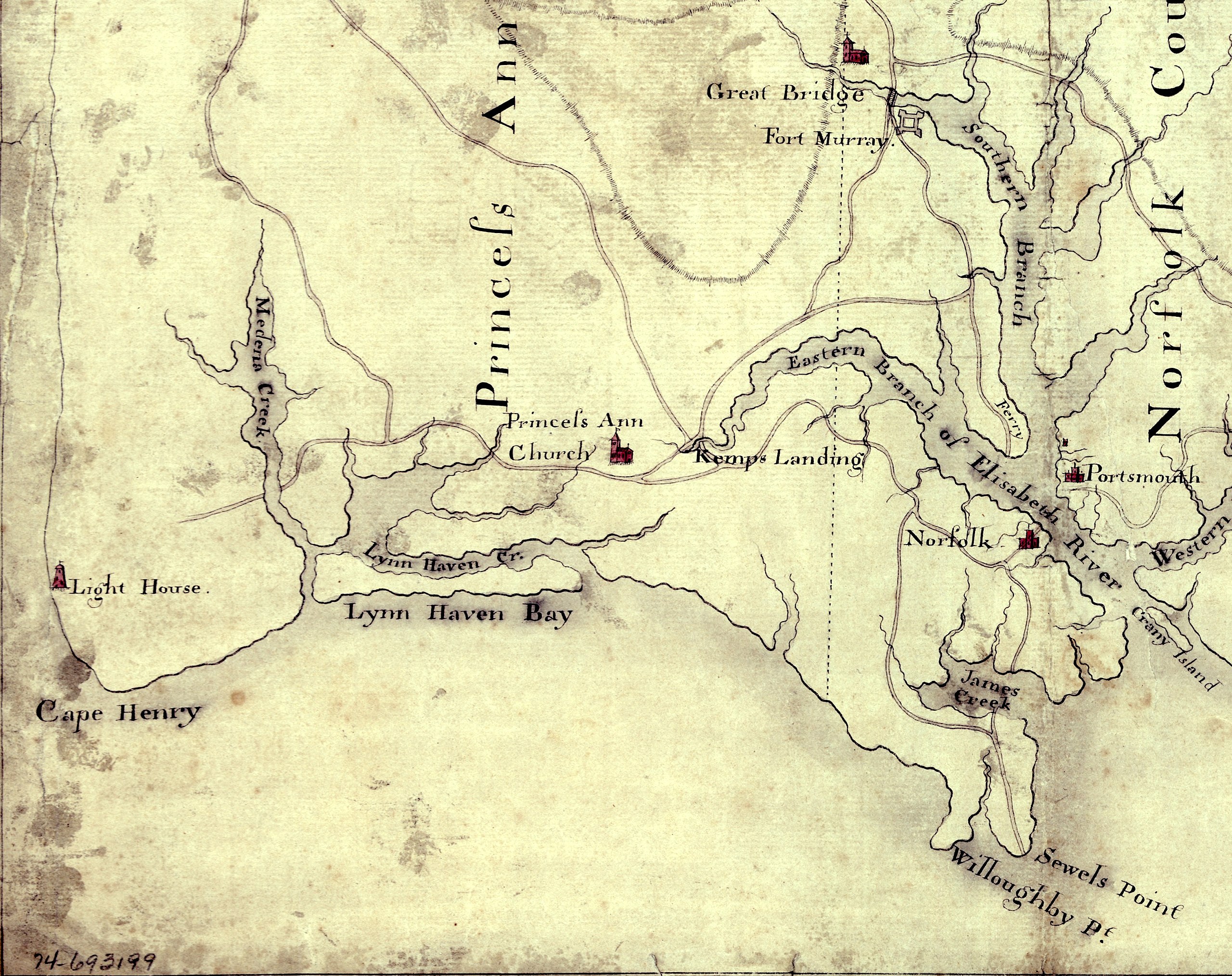
| current | 15:58, 5 August 2010 | | 3,360 × 2,660 (2.84 MB) | commons>Magicpiano | {{Information |Description={{en|Detail of a 1770s manuscript map depicting the eastern coastal areas of Virginia, including portions of Princess Ann and Norfolk Counties. The map is oriented with North to the bottom and South to the top. Part of the |
File usage
There are no pages that use this file.