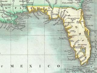
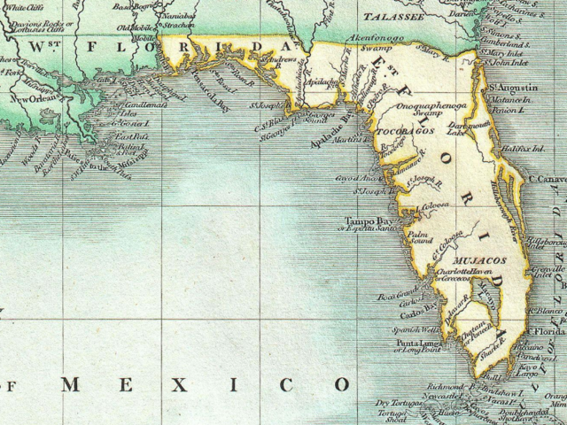
File:East and West Florida 1803 Cary Map.png
Jump to navigation
Jump to search

Size of this preview: 799 × 600 pixels. Other resolutions: 320 × 240 pixels | 640 × 480 pixels | 846 × 635 pixels.
Original file (846 × 635 pixels, file size: 1.37 MB, MIME type: image/png)
File history
Click on a date/time to view the file as it appeared at that time.
| Date/Time | Thumbnail | Dimensions | User | Comment | |
|---|---|---|---|---|---|
| current | 01:23, 17 November 2020 | | 846 × 635 (1.37 MB) | commons>Jeff in CA | Uploaded a work by John Cary from Cary, John, ''Cary's New Universal Atlas, containing distinct maps of all the principal states and kingdoms throughout the World. From the latest and best authorities extant''. London: Printed for J. Cary, Engraver and Map-seller, No. 181, near Norfolk Street, Strand, 1808. http://www.geographicus.com/P/AntiqueMap/WestIndies-cary-1803 with UploadWizard |
File usage
There are no pages that use this file.