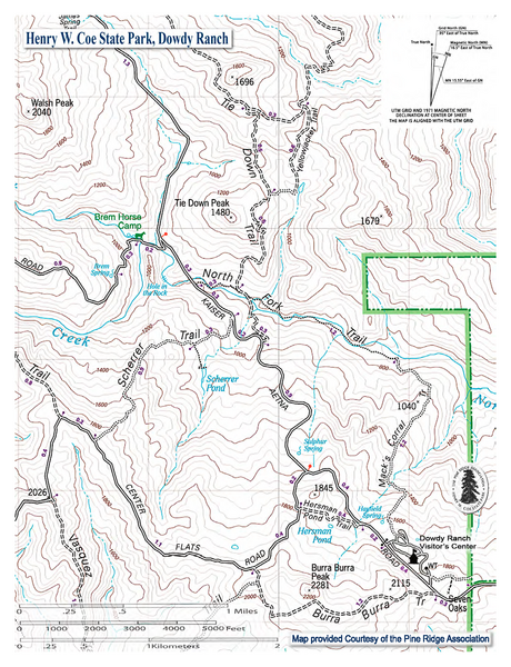
File:Dowdy Ranch Visitor's Center Kaiser-Aetna Road North Fork Pacheco Creek USGS MAP Pine Ridge Association.png
Jump to navigation
Jump to search

Size of this preview: 460 × 600 pixels. Other resolutions: 184 × 240 pixels | 368 × 480 pixels | 589 × 768 pixels | 1,275 × 1,662 pixels.
Original file (1,275 × 1,662 pixels, file size: 2.93 MB, MIME type: image/png)
File history
Click on a date/time to view the file as it appeared at that time.
| Date/Time | Thumbnail | Dimensions | User | Comment | |
|---|---|---|---|---|---|
| current | 23:54, 7 December 2021 | | 1,275 × 1,662 (2.93 MB) | commons>Schmiebel | Uploaded a work by United States Geological Survey Map and Pine Ridge Association/Henry Coe State Park from https://coepark.net/images/maps/dowdy_vc_area.pdf with UploadWizard |
File usage
There are no pages that use this file.